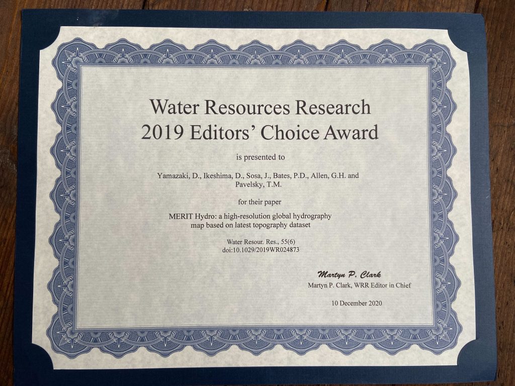

UoB Water Group and Fathom receive WRR Editors’ Choice Award

Awards and prizes 17.12.2020
Intro

Their paper on MERIT Hydro, co-written with Dai Yamazaki, made major advances in our ability to represent river networks globally.

As 2020 draws to a close, Fathom are pleased to announce that University of Bristol Water Group researchers, and Fathom team members, Jeison Sosa and Paul Bates have been awarded a Water Resources Research (WRR) Editors’ Choice award for 2020.

This award was received as a result of their contribution to Dai Yamazaki’s paper on MERIT Hydro, a high‐resolution global map of river network developed by combining the latest global map of topography with the latest maps of water bodies. MERIT Hydro represents a major advance in our ability to represent river networks globally and is a data set that is anticipated to enhance a wide range of geoscience applications including flood risk assessment, aquatic carbon emissions, and climate modelling.

WRR is published by the American Geophysical Union and is the leading technical journal for scientists working in flood mapping. WRR awards are given to the top 1% of papers published each year and awards papers based on their quality, significance and originality.

We are delighted that Fathom research has been acknowledged in this way. In the new year, we look forward to continuing collaboration with the University of Bristol to produce industry-leading research contributing to the advancement of the flood modelling and hydrology field.

Fathom’s latest research

arrow-light-short-left
arrow light short right
Read more
New Research paper

Evaluating SWOT in the Coastal Zone

  • Rong, Y.,
  • Bates CBE FRS, P.,
  • Neal, J.,
  • Bell, P.,
  • Gommenginger, C.,
  • Lichtman, I.,
  • Banks, C.,
  • Calafat, F.,
  • Martin, A.,
  • Brown, J.,
  • Cooke, R.,
  • Balfour, C.,
  • Dominicis, M.,
  • Payo, M.,
  • Williams, S.,
  • Amoudry, L.,
  • Chuter, S.,
  • Neill, S.,
  • Chisholm, J.,
  • Kupiec, J.,
  • Lewis, M.,
  • Gleason, C.

01/24/2026
Read more
Composite image comprising two graphs. The figure on the right shows the results from applying the EQD and TAILS methods to every GESLA record used in this study, showing the distributions of quantile probabilities of the selected thresholds. On the left are spatial plots of (a) the quantile probabilities of selected thresholds using the TAILS methods, and (b) the difference in the quantile probabilities of the selected thresholds between the TAILS and EQD approaches.
Research paper

Automated tail-informed threshold selection for extreme coastal sea levels

A new method, TAILS, sharpens how we identify extreme events by focusing on the most critical data, giving clearer, more reliable estimates of future coastal hazards worldwide.

11/17/2025
Read more
BURGER rainfall intensity derived with regionalized SMEV parameters for a 1 hr, 200 years rainfall event. The gray rectangles correspond with 13 areas of interest which have been assessed individually in Section 3.2.3 to evaluate BURGER's similarity with GPEX.
Research paper

Introducing BURGER, Fathom’s new extreme rainfall dataset

  • Hoch, J.,
  • Probyn, I.,
  • Marra, F.,
  • Lucas, C.,
  • Bates, J.,
  • Cooper, A.,
  • Fowler, H.,
  • Hatchard, S.,
  • Lewis, E.,
  • Savage, J.,
  • Addor, N.,
  • Sampson, C.

New research by Fathom’s Senior Hydrologist, Dr Jannis Hoch, and other Fathom scientists describes Fathom’s new dataset, Bottom Up Regionalised Global Extreme Rainfall, or BURGER for short. It’s the first of its kind to be created from rainfall gauge data and the first to contain extreme estimates for durations as short as an hour.

10/13/2025
Read more
Satellite to capture water propogation of Earth's river
Research paper

Satellite Requirements to Capture Water Propagation in Earth’s Rivers
  • Cerbelaud, A.,
  • David, C.,
  • Pavelsky, T.,
  • Biancamaria, S.,
  • Garambois, P.,
  • Kittel, C.,
  • Papa, F.,
  • Bates, P.,
  • Tourian, M.,
  • Durand, M.,
  • Frasson, R.,
  • Oubanas, H.,
  • Simard, M.,
  • Schumann, G.,
  • Allen, G.,
  • Tarpanelli, A.,
  • Wongchuig, S.,
  • Wade, J.,
  • Tom, M.,
  • Malaterre, P.,
  • Crétaux, J.,
  • Gleason, C.,
  • Nielsen, K.,
  • Elmi, O.,
  • Schwatke, C.,
  • Scherer, D.,
  • Gal, L.,
  • Paris, A.,
  • Dasgupta, A.,
  • Munier, S.,
  • Feng, D.,
  • Bauer-Gottwein, P.,
  • Hossain, F.,
  • Yamazaki, D.,
  • Kitambo, B.,
  • Mischel, S.,
  • Bonnema, M.,
  • Verma, K.,
  • Andreadis, K.,
  • Picot, N.,
  • Benveniste, J.,
  • Dourand, M.

07/22/2025
Read more
Research paper

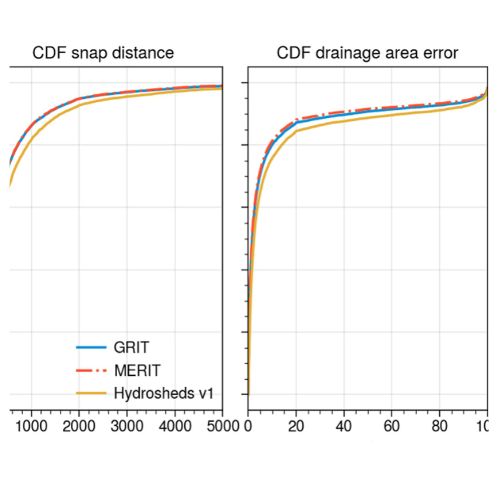
Global River Topology (GRIT): A bifurcating river hydrography

  • Wortmann, M.,
  • Slater, L.,
  • Hawker, L.,
  • Liu, Y.,
  • Neal, J.,
  • Zhang, B.,
  • Schwenk, J.,
  • Allen, G.,
  • Ashworth, P.,
  • Boothroyd, R.,
  • Cloke,, H.,
  • Delorme, P.,
  • Gebrechorkos, S.,
  • Griffith, H.,
  • Leyland, J.,
  • McLelland, S.,
  • Nicholas, A.,
  • Sambrook-Smith, G.,
  • Vahidi, E.,
  • Parsons, D.,
  • Darby, S.

Researchers have created the first branching global river network that represents bifurcations, multi-threaded channels and canals.

05/15/2025
Read more
FathomDEM AI tiles terrain
Research paper

FathomDEM Global Terrain Map

A new research paper published in Environmental Research Letters outlines the creation of FathomDEM, a new global 30 m DEM produced using a novel machine-learning approach.

02/11/2025

You May Like

View all posts
Fathom partners with WSP to provide climate-conditioned flood data to WSP teams across the globe
Partnerships

Fathom partners with WSP

Partnerships

Fathom models integrated with Altitude’s platform

Global Terrain Data example image from FathomDEM+
Product launches

Fathom launches FathomDEM+

Swiss Re intergrates Fathom data
Company updates

Swiss Re integrates Fathom data into its internal view of flood risk

Partnerships

Fathom data integrated with Climate X

Fathom data reveals hidden flood risks across Washington D.C. transportation system
Industry insights

Fathom data reveals hidden flood risks across Washington D.C. transportation system