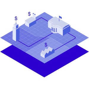
Engineering flood resilience
Subsecond access to global terrain and flood risk data
for infrastructure planning, risk assessments and long-term resilience


Identifying and mitigating the potential impact of physical risks, such as present and future flooding, is essential for ensuring the successful delivery of infrastructure projects and enhancing long-term climate resilience.
Yet, engineers still face significant challenges in accessing credible, consistent, broadscale flood and climate risk data at all stages of the infrastructure lifecycle.
Fathom overcomes these challenges with global flood and climate data, enabling engineers, climate specialists and GIS analysts to rapidly access, analyse and make more informed decisions based on scientifically robust data earlier in any project. As a leading provider of award-winning flood data, we support AEC organizations, asset owners, climate specialists and digital engineers to embed meaningful risk governance within engineering practices. With global coverage, Fathom helps engineers in:
Project delivery and stakeholder engagement
Make timely, early-stage decisions using Fathom data. Fathom current and future flood hazard data supports more informed decisions in the earlier stages of a project to help shape what-if scenarios, site selection, design and funding alternatives and more appropriate allocation of resources for project delivery.
The easy access to Fathom data provides a consistent and broadscale understanding of flood risk and so significantly reduces time and costs for sourcing and modelling data for the initial project decisions.
Climate risk assessment and management
Conduct flood and climate risk assessments to understand the current and future flood risk of any assets or infrastructure globally.
Linear assets such as rail, highway or utility networks are particularly suited to using Fathom data.
Determine flood resilience and analyze flood inundation depth with water surface elevation data for each return period and climate scenario.
Fathom’s future flood scenarios can be used to identify critical assets and infrastructure at risk to support funding and design options and develop resiliency strategies to combat climate change and help increase the lifespan of assets.
Regulatory compliance and reporting
Rapidly screen asset portfolios to understand their exposure to flooding today and in the future under various emission scenarios and time horizons.
Customise the data to suit your regulatory needs, or access one of our recommended climate options – designed to aid more detailed, consistent and transparent reporting.
Geospatial analysis and mapping
Integrate Fathom data within your GIS platform, data marketplace or digital twin with sub-second access through our API.
Reduce project lead times and improve decision-making with Fathom’s globally consistent flood, climate and terrain datasets at point of need.
Augment internally held historic flood risk information with large-scale flood maps to create powerful digital environments that can support full-cycle projects.
Where does Fathom fit in?
At the project initiation and analysis stage, Fathom offers rapid access to consistent, broadscale, high-quality data to inform early decision-making and support project bid processes.

Fathom provides early-stage understanding of flood risk and rapid analysis of risk at scale
Site assessment and selection

Site screening, feasibility analysis and early-stage option assessments of existing or prospective assets
Data in action: Accelerating renewable energy site selection across the US
Managing linear assets

Assess resilience and prioritize resources to improve business planning and asset management
Data in action: See how advanced flood data helps prioritise climate adaptation across national rail assets
Critical infrastructure management

Portfolio assessment and impact analysis to analyze resilience and support digital twins
Data in action: Revealing hidden flood risks across transportation systems
Climate vulnerability assessments

Climate-conditioned flood maps for multiple scenarios, return periods, and percentiles to define future flood risk and aid regulatory reporting
Data in action: Filling the data gap to support Florida’s Statewide Flooding and Sea Level Rise Resilience Plan
Supporting climate-vulnerable communities

Filling the data gaps in data-sparse areas to provide a comprehensive and consistent flood map to support community resilience planning
Data in action: Demonstrating how urban greening can alleviate flood risk in Dar es Salaam with rapid bespoke modeling
Funding applications
Provide early evidence to support funding applications for international development, state-level federal grants or CapEx investment.
Built on peer-reviewed, validated science, Fathom’s transparent terrain and flood hazard data power a wide range of applications—let’s explore how it can drive your project forward.
In a world of uncertainty, Fathom offers:
High resolution, globally consistent view of flood risk
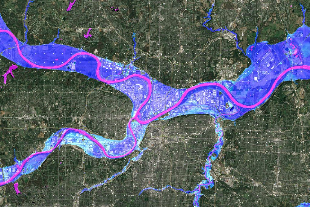
Understand potential flood risk, build resilient infrastructure and conduct risk assessments anywhere globally with truly global flood maps.
Analyse flood extent and depth (water surface elevation) for any asset or location globally, at high resolution, for now and in the future.
Scalable flood risk data
Fathom offers scalable flood risk data that is valuable for both small site or country scale analysis.
Engineers can choose between readily available off-the-shelf models or work with our team of specialists to produce bespoke models that can be built within error of a real-world event.
Rapid access to our dynamic data, delivered in a range of formats
Gain subsecond access to Fathom’s of-the-shelf datasets with Fathom’s API – ideal for projects with short timelines or for use in tenders.
Our highly detailed bespoke projects delivered in months, not years. Learn about our work with the Texas Water Development Board.
All climate change scenarios
Respond to any scenario test or regulatory framework with Fathom’s flexible with Fathom’s Climate Dynamics framework.
Fathom’s Climate Dynamics framework enables risk managers to represent any plausible future or what if scenario up to 2100.
Explore Fathom’s approach to climate risk and flood data modeling.
Fully transparent data
Know exactly where the data comes from, the methodologies and validation techniques underpinning it and how they’ve been independently assessed for quality.
Fathom’s products are based on the latest scientific advancements: All map methodologies are published in peer-reviewed journals.
Explore the components of our products in the Fathom product stack.
Ongoing customer support
Fathom has an in-house dedicated team of specialist customer support to ensure that you are making the most of your data.
This service is accompanied by extensive documentation for model users including methodology docs, Knowledge Hub and account managers.
Learn how Fathom supported Texas to build the first government-led state-wide flood map in just 6 months.
Streamline planning, reduce costs and increase project efficiency
At the project initiation and analysis stage, Fathom offers rapid access to consistent, broadscale, high-quality data to inform early decision-making and support project bid processes.
Using Fathom data on water, flood and climate resilience projects not only simplifies the early stages of planning but also offers a substantial return on investment. Here’s how:
Cost savings
Traditional flood mapping requires significant funding ($10k–$30k per single site assessment and $150k-$5m+ for broadscale mapping). Fathom’s ready-to-use maps reduce these costs,
and improve budget efficiency.
Time efficiency
Building custom flood models can take years and delay projects. Fathom maps are instantly available, speeding up timelines and reducing costs.
Increased focus on detailed analysis and mitigation
By removing the need to build baseline flood models from scratch, teams can redirect effort toward higher-value work, such as site-specific diagnostics, sensitivity testing and the design of targeted mitigation measures that directly reduce risk.
Evidence-based future-proofing
Consistent, defensible flood data enables more robust planning decisions by explicitly accounting for current and future risk drivers, including climate change and development pressure, supporting long-term resilience strategies rather than reactive fixes.
Opportunity cost savings
Faster access to flood intelligence allows projects to move forward sooner, reduces delays in approvals and investment decisions, and frees technical and financial resources for parallel initiatives that would otherwise be deferred.
Scalability and flexibility
Standardised, ready-to-use maps can be applied across portfolios, regions, or asset classes with minimal additional effort, enabling organisations to scale assessments quickly while retaining the flexibility to layer in local detail where required.
Discover the US Flood Risk Index
Explore Fathom’s US Flood Risk Index: a new interactive tool that gives floodplain managers, planners, and risk engineers a detailed, state-level view of flood exposure across map coverage, population, and vulnerable infrastructure like roads and rail.
Research-driven flood data that you can trust
Our flood data have been subject to the highest level of scientific scrutiny. Fully verifiable and traceable, it is expertly compiled by our scientists in collaboration with a global network of independent researchers and institutions.
These data are rooted in science, with their methodologies published in peer-review journals, including some of the most respected and rigorously assessed titles in the academic world. Our academic work is some of the most cited in its field.
Our products
Interested in learning more about Fathom’s solutions for infrastructure planning, risk management and portfolio screening?