The first statewide flood planning program
Texas Water Development Board accelerates the development of the first statewide flood planning program in the absence of publicly available flood data
The problem In 2019, the Texas Legislature tasked the Texas Water Development Board (TWDB) with delivering the first-ever statewide flood plan for the State of Texas
This project was led by Reem Zoun, the Director of Flood Planning, and Director of Flood Science and Community Assistance, Saul Nuccitelli.
In 2020, fifteen regional planning groups were formed and they worked together on the mission for a statewide flood view by bringing together sets of regional flood plans. To enable the regional flood planning groups in their efforts the TWDB gathered together various flood-related data in a Flood Planning Data Hub.
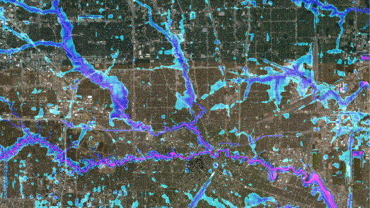
The group identified and compiled comprehensive flood hazard data for each region based on the best available information. This informed a plan to develop a “flood quilt” of data taken from a variety of sources including federal and state flood risk data, natural flood hazard layer datasets, base-level engineering (BLE), and digitized paper (FIRMS).
However, there were gaps in the publicly available data as approximately 63 counties did not have any existing flood maps.
The solution Where regional flood data was outdated or unavailable the TWDB worked with contracted engineering firms to fill in the gaps
With an extensive academic portfolio and proven experience working within the US, Fathom’s flood data was incorporated into a floodplain quilt layer to provide a statewide rapid assessment flood inundation layer until BLE (base level engineering) can be completed. To facilitate this activity a Texas-based engineering firm, Aqua Strategies (www.aquastrategies.com) was enlisted and worked closely with Fathom and the TWDB to ensure that the data met the stringent standards of the Regional Flood Planning Groups who will ultimately benefit from the project.
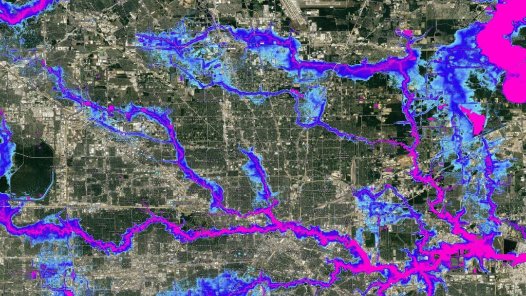
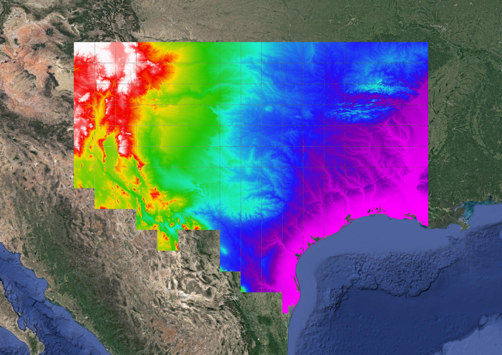
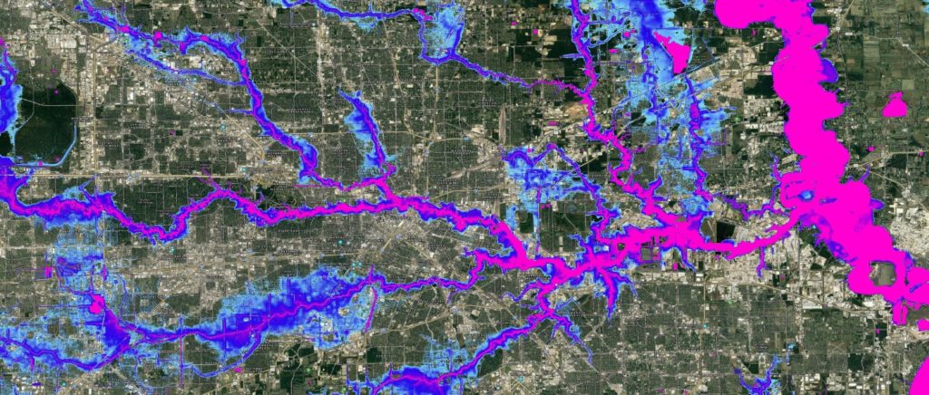
To meet the project needs, Fathom compiled a ~10ft Digital Elevation Model (DEM) of the entire state, built using over 300,000 individual laser altimeter datasets (LiDAR). A customized hydraulic model was then run over this DEM, with the hydraulics computed at ~100ft.
These results were downscaled to ~10ft resolution, providing an output of flood depths for pluvial, fluvial, and coastal flooding at four different frequencies: 1 in 5 (20% chance in a given year), 1 in 10 (10%), 1 in 100 (1%), and 1 in 500 (0.2%).
The results The flood planning program resulted in a flood planning hub for flood data and resources. Data layers for critical infrastructure, flood infrastructure, flood risk, hydrology, jurisdictional boundaries, parks, population, property, terrain, and transportation were included as part of this flood risk resource
Three depths for each flood frequency at a 10ft resolution were “mosaicked” together to enable the selection of the greatest flood depth where the different datasets overlap.
Composed of state and federal flood risk data, TWDB effectively reached their goal of achieving a consistent flood risk layer for the entire state of Texas, USA at a 10ft resolution with their floodplain quilt.
Discover Fathom’s new US Flood Map
The most complete and technologically advanced flood map for the United States to date.
Related case studies

The Nature Conservancy
The Nature Conservancy worked with Fathom to understand flood risk and identify large scale exposure to flooding across different demographics and the impact of future climate scenarios.
Arup & World Bank
Fathom & Arup demonstrate how rapid, data-driven flood modeling can quantify the impact of urban greening on flood extent, soil erosion, and urban heat. Discover how NBS can create more resilient cities.


Bank of England
Fathom supported the Bank of England in their analysis of submissions for CBES 2021 using the Fathom-UK CAT model.
Quote We would like to express our gratitude to both the physical risk open data providers as well as to the plethora of technical experts for all of their contributions to this exercise over the past two years.

Canopius
Global (re)insurer, Canopius, used Fathom-US flood hazard data to quantify their exposure to flooding to inform pricing and facilitate exposure management.