
New research led by Yinxue Liu and co-authored by Fathom’s Paul Bates and Jeff Neal tests ways to generate bare-earth data from ArcticDEM, one of the next-generation digital elevation models that could become an alternative to radar-based DEMs such as MERIT and and Fathom’s own FABDEM.
Bare-earth digital elevation models (DEMs) represent the topography of the Earth’s surface – without above-ground objects such as vegetation or buildings.
They are crucial for many fields of research, including flood modeling – especially when simulating urban flooding over a wide area. That’s because in large-scale flood simulations at coarse resolutions, objects such as buildings and trees can change the flow of flood water over the surface in a way that skews the results. Without a bare-earth digital terrain model, the ground surface would appear to be at the height of buildings and trees and would therefore not flood.
Read our article: The new standard for a globally consistent multi-source digital elevation model: Meet FABDEM+
In the past, DEMs (also known as digital terrain models, or DTMs) were derived mainly from topographic maps. Today’s models, however, are created via remote sensing from ground vehicle, airborne or satellite platforms. They all include at least some artifacts and vegetation that need to be removed via post-processing in order to generate bare-earth data.
- DEM collection techniques include:
Interferometric synthetic aperture radar (i.e. InSAR) - Optical stereo mapping
- Photogrammetry
- LiDAR (light detection and ranging).
The next-generation photogrammetric DEMs
For flood simulation, airborne LiDAR DEMs are currently considered the best data source, thanks to their fine resolution and high accuracy. But freely available LiDAR data only covers a small proportion of the Earth’s surface.
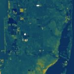
Now, however, a number of extremely high-resolution satellite photogrammetric DEMs are emerging that could be powerful tools for urban flood-modeling at scale. One of these is the publicly available ArcticDEM, which covers the area above 60° N with an unparalleled resolution of 2 m and vertical accuracy similar to LiDAR.
There has been limited investigation into how to remove surface artifacts from ArcticDEM data. This research article aims to fill that gap and examine the use of bare-earth ArcticDEM in flood modeling.
The research: Removing surface artifacts from ArcticDEM
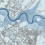
ArcticDEM is a digital surface model (DSM), which means it includes above-ground objects. The research team tested two different morphological filters to remove the artifacts from ArcticDEM terrain data, using Helsinki, Finland, as a case study.
- First, the team compared a simple morphological filter (SMRF) with a progressive morphological filter (PMF) and assessed them against a benchmark bare-earth LiDAR.
- Next, they applied a set of parameter combinations (window size and slope threshold) to the best-performing filter to generate filtered ArcticDEM, and examined the error metrics against the parameter settings.
- The researchers then used both the original and the filtered ArcticDEM data to model pluvial flooding in Helsinki, and compared them to an identical simulation using LiDAR.
Key findings: Comparison to LiDAR
As far as the researchers are aware, this was the first time morphological filters were tested to generate bare-earth ArcticDEM data specifically for flood applications. Key findings include:
- The simple filter (SMRF) was better at removing surface artifacts from ArcticDEM than the progressive filter (PMF).
- The SMRF reduced the errors of the unfiltered ArcticDEM by up to 70 %.
- When used in a pluvial flood simulation, the bare-earth ArcticDEM showed a significant improvement in predicting inundation extent and water depth compared to the LiDAR data.
- The approach tested in this research paper should be applicable to other high-resolution photogrammetric DEMs.
Overall, the results suggest that where LiDAR data is non-existent or unaffordable (in developing countries, for example), bare-earth satellite photogrammetric DEMs could offer a promising alternative.
Further reading
Over a dozen research papers and datasets conducted by Fathomers can be found in the list of references for this research paper. Helping support scientific advancement is one of the key reasons we prioritize the development of new research, which is published in open and leading academic journals.
Research includes:
Read the full paper
Related content
Hyper-resolution PCR-GLOBWB: opportunities and challenges from refining model spatial resolution to 1 km over the European continent

Use of hydrological models in global stochastic flood modeling
Assessing flooding impact to riverine bridges: an integrated analysis
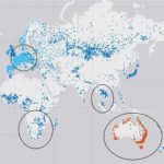
Increased population exposure to Amphan-scale cyclones under future climates
A 30 m global map of elevation with forests and buildings removed
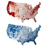
Inequitable patterns of US flood risk in the Anthropocene