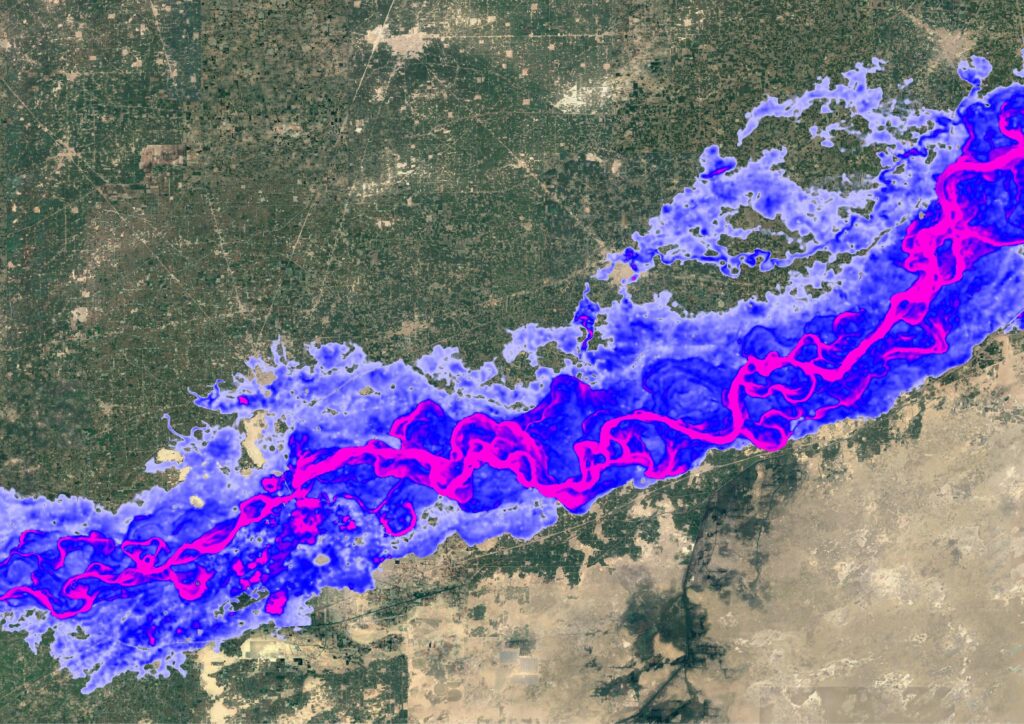
Fathom’s award-winning Global Flood Map provides its users with the most robust and comprehensive set of hazard data and flood risk information in the world. Available across all major flood perils: pluvial, fluvial and coastal, it revolutionizes how insurers, financial markets, engineers, corporates and governments can understand and integrate flood hazard and climate change data into their risk operations.
Key features of Fathom’s Global Flood Map
~30-meter resolution globally
1 arcsecond data, based on FABDEM+, our latest complete map of the Earth’s terrain
Downscaled to 10-meter resolution where advanced regional data permits
Climate Dynamics
Fully flexible climate conditioned flood hazard data for any projected combination of future year and climate scenario up to 2100
Multi-peril flood layers
Fluvial, pluvial and coastal flooding – Assess the risk from major types of flood including defended and undefended views. With flood depths for return periods between 5 – 1000 years and Risk Scores (Relative Risk and Risk Category) for each type of flooding
Terrain data
Underpinned by an unparalleled Digital Elevation Model (DEM) combining FABDEM with the best available local LiDAR data
Access
Gain instant on-demand access via the Fathom API and Fathom Portal, or host the data on-premise
Metadata
Providing transparency with additional information within our maps to provide you with a better understanding of the influencing factors that may impact the certainty of flood risks, across all flood perils.
Flood map regional enhancements
- Regional Enhancements
- Global Flood Map
- No coverage
Global Flood Map
Key features
01 – ~30-meter resolution globally
02 – Climate Dynamics
Flood hazard data for any projected combination of future year and climate scenario
03 – Fluvial, pluvial and coastal flooding
04 – Terrain data
Blending FABDEM with the best available local data
05 – Access
Instant on-demand access to all of Fathom’s data
06 – Flood layers
Available as either Depths (by return periods) or Risk Scores
US Flood Map
Key features
01 – Climate Dynamics
Updated 2020 climate state
02 – 10 return periods
Ranging from 1-in-5 year to 1-in-1000 year
03 – Coverage
— Fathom covers 100% of contiguous US
— FEMA covers 60% of contiguous US
04 – Inland flooding
05 – Access
Via the Fathom API, Fathom Portal, direct provision or via a partner
06 – ~10 meter resolution
UK Flood Map
Key features
01 – Climate Dynamics
5 climate scenarios across 3 time horizons
02 – 10 return periods
Ranging from 1-in-5 year to 1-in-1000 year
03 – Defenses
Unique detection algorithm that identifies flood defenses where data are not available
04 – Inland and coastal flooding
05 – Access
Via the Fathom API, Fathom Portal, direct provision or via a partner
06 – ~10 meter resolution
Japan Flood Map
Key features
01 – ~10 meter resolution
02 –Climate Dynamics
5 climate scenarios across 3 time horizons
03 – Inland and coastal flooding
04 – 11 return periods
Ranging from 1-in-5 year to 1-in-2500 year
05 – Access
Via the Fathom API, Fathom Portal, direct provision or via a partner
05 – Defenses
Flood defenses are explicitly built-in using a new levee detection algorithm
Key features
01 – ~30-meter resolution globally
02 – Climate Dynamics
Flood hazard data for any projected combination of future year and climate scenario
03 – Fluvial, pluvial and coastal flooding
04 – Terrain data
Blending FABDEM with the best available local data
05 – Access
Instant on-demand access to all of Fathom’s data
06 – Flood layers
Available as either Depths (by return periods) or Risk Scores
Key features
01 – Climate Dynamics
Updated 2020 climate state
02 – 10 return periods
Ranging from 1-in-5 year to 1-in-1000 year
03 – Coverage
— Fathom covers 100% of contiguous US
— FEMA covers 60% of contiguous US
04 – Inland flooding
05 – Access
Via the Fathom API, Fathom Portal, direct provision or via a partner
06 – ~10 meter resolution
Key features
01 – Climate Dynamics
5 climate scenarios across 3 time horizons
02 – 10 return periods
Ranging from 1-in-5 year to 1-in-1000 year
03 – Defenses
Unique detection algorithm that identifies flood defenses where data are not available
04 – Inland and coastal flooding
05 – Access
Via the Fathom API, Fathom Portal, direct provision or via a partner
06 – ~10 meter resolution
Key features
01 – ~10 meter resolution
02 –Climate Dynamics
5 climate scenarios across 3 time horizons
03 – Inland and coastal flooding
04 – 11 return periods
Ranging from 1-in-5 year to 1-in-2500 year
05 – Access
Via the Fathom API, Fathom Portal, direct provision or via a partner
05 – Defenses
Flood defenses are explicitly built-in using a new levee detection algorithm
Accessing Global Flood Map
Fathom API
Fathom’s API is a cloud-based solution for data provision that enables users to access Fathom data on-demand directly.
Fathom Portal
Fathom’s Portal is an interactive platform that enables users to host, view and analyze data, without the need for an in-house platform.
On premise
Fathom’s products can be provided directly as a set of GeoTIFF files and hosted on premise.
Partners
Fathom data is available through a range of partners.


