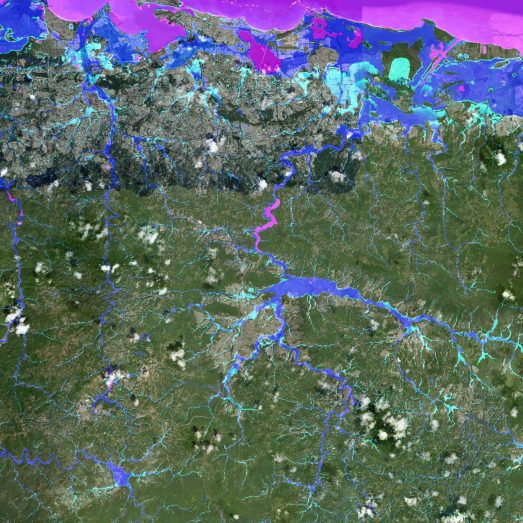

Our flood model of the continental United States, Fathom-US, has undergone extensive testing against FEMA’s vast inventory of engineering-grade local models.
The results of this flood model evaluation exercise have been published in the peer-reviewed scientific journal Water Resources Research. Large-scale flood models have never before come under this level of scrutiny: comparison to high quality flood maps that cover virtually an entire continent constitutes a validation methodology that is without precedent. Further to these FEMA flood maps – created by the agency to enforce the regulations of the National Flood Insurance Programme (NFIP) – Fathom-US is tested against a handful of USGS studies as well.
Flood Model Evaluation Findings
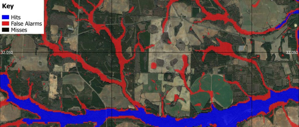
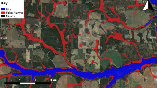
The paper reports that Fathom-US captures 86% of the 1 in 100 year flood zone delineated by the highest quality FEMA models. When compared to USGS data, Fathom-US captured rates are even higher. Model performance is generally better on larger rivers and in temperate climates. These results demonstrate that our large-scale modelling approach can largely replicate government agency flood maps, especially in light of the typical uncertainties involved in hydraulic modelling.
What this means for Flood Mapping
This study is nothing short of a landmark for both the field of academic enquiry and for flood mapping as an industry. It establishes that the large-scale modelling approach Fathom has developed reaches broadly the same conclusions about flood hazard as bespoke local models built at great expense by teams of surveyors and engineers. It is estimated that FEMA has spent up to $7.5 billion on flood mapping up to 2013 to generate these maps. With the NFIP in severe financial trouble and no further funding to maintain and update the FEMA maps, our methodology provides a clear solution to the problems facing flood hazard mapping in the USA.
Validation of a 30m resolution flood hazard model of the conterminous United States
The first peer-reviewed validation of a continental-scale, high-resolution flood hazard model; this paper won the prestigious AGU Editors’ Choice Award in 2018.