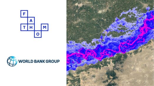

A fundamental change in our global view of flood risk
Today, we launched our new Global Flood Map, Fathom-Global 3.0. For the first time risk professionals can access all perils and climate options.
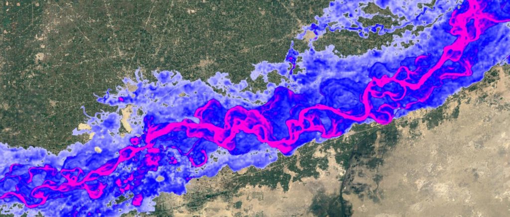
Unlike most maps that are limited to inland fluvial and pluvial flood data, Fathom-Global 3.0 also models coastal flood risk. In addition, users can access flood maps that draw on scientific data representing the size, width, depth and flow of every river channel in the world, providing unprecedented levels of detail.
Fathom-Global 3.0 enables users to quantify and mitigate flood risk, and understand changes in risk under future climate scenarios. The map is at 30-metre resolution globally and is based on terrain data from FABDEM, Fathom’s latest complete ‘bare earth’ Digital Elevation Map of the Earth’s terrain, enriched with LiDAR data where it is available.
“We launched Fathom in 2013 with an aim to deliver science-driven and fully transparent flood modelling and to accelerate the world’s understanding of flooding on a global scale. Fathom-Global 3.0 is our biggest step yet to making high quality flood hazard data accessible worldwide. It is by far the most robust and comprehensive flood dataset available today” explains Fathom co-founder Dr Andrew Smith.
“Having reliable and sound flood hazard data is fundamental to understanding the exposure and resultant vulnerability of any property, facility and asset. This is especially important for risk professionals across many industries who, until now, have struggled to obtain complete and consistent data across all the countries in which they have business,” Smith continued.
Fathom’s new Climate Dynamics framework is the only technology on the market that allows users to customise their data to varying regulatory requirements. Users can examine any inland or coastal flood peril for any projected combination of future year and climate scenario or temperature change – bringing to market a new ability to understand flood-related climate change impacts.
Unlike other flood maps which rely primarily on observational data, Fathom-Global 3.0 draws on extensive peer-reviewed academic research and scientific data sources to simulate the behaviour of water across all flood perils.
In another major development, the data is accessible via the new Fathom API. This allows customers who prefer on-demand use to access all spatial data without the need to host files. For customers who wish to bring the dataset in-house or access data via a Fathom partner, Fathom continues to offer a range of flexible data access options.
Related webinar: The making of Fathom’s Climate Dynamics framework


Learn more about Fathom’s Global Flood Map
Fathom-Global 3.0 is the most robust and comprehensive global flood map in the world. It revolutionises how insurers, financial institutions, engineers, corporates and governments can understand and integrate flood hazard and climate change data into their risk operations.
We are hosting a series of webinars that will explore, in detail, the development and key features of the flood maps. Kicking off today at 16:00 (BST), the first webinar will provide an overview of the what is available with the release. You can register here.
The next webinar will take place on November 16th and will explain “The making of Fathom’s Climate Dynamic framework”. You can register here.
Want to access Fathom’s more technical literature? Request this using the form below.
01 – Fluvial, pluvial and coastal perils. The first complete global view of all flood hazards
02 – Climate dynamics. Allows you to produce climate change flood maps for a flexible range of different time periods, warming levels and emissions scenarios
03 – Terrain Data. Fathom-Global is underpinned by a Digital Elevation Model (DEM) of unparalleled quality that combines FABDEM with the best available local data
04 – API. Fathom’s API allows instant access to all of our spatial data in a straightforward manner
05 – 100% of river channels. Complete global coverage of every river, dynamically modelled to estimate channel size and river depth.
06 – Risk Score. Including Relative Risk and Risk Category.
For insurance and reinsurance: Flood hazard data is fundamental to understanding the exposure and resultant vulnerability of any property, facility or asset. This is especially important for insurance and reinsurance professionals who, until now, have struggled to obtain complete and consistent data across all the countries in which they have business.
For banking, advisory and capital markets: Fathom-Global 3.0 will particularly help institutions who are assessing portfolio risk across both data-rich and data-poor areas of the world. Providing a comprehensive picture of flood risk for the first time. Firms will be able to fully understand portfolio flood risk, consider the necessary precautions to mitigate it and answer regulatory, legislative and customer demands for risk management and reporting.
For engineering, government and international development: Reliable and sound flood hazard data is fundamental to understanding the exposure and resultant vulnerability of any potential site, project, infrastructure or asset. This is especially important to engineers working on feasibility, scoping and risk assessment for projects in data scarce regions that need to meet specific requirements over the lifetime of and asset. Fathom-Global 3.0 will prove vital to engineers, governments and international development organisations who are compelled to conduct ever more detailed and precise assessments.
Contact usInterested in Fathom’s Global Flood Map?
If you are interested in accessing documents on our methodologies, obtaining free sample data or licensing the flood map, please get in touch. Our team of flood specialists will be happy to assist.