Global Terrain Data – FABDEM+
The new standard for a globally consistent and accurate digital elevation model
Introduction FABDEM+ offers a seamless blend of FABDEM and enhanced local data to provide best-in-class elevation information for every location in the world.
Comprising consistent elevation data and comprehensive metadata it ensures access to the most accurate terrain information. Available at 1 arcsecond (~30 m) worldwide and up to 1/3 arcsecond (~10 m) in areas where we have enhanced data, its capability to provide ‘bare earth’ elevations makes it suitable for a wide range of use cases including the planning of linear assets, mapping natural perils, and creating artificial digital environments.
FABDEM+ key features
Coverage
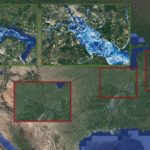
LiDAR: 30+ countries, 10 million km².
FABDEM: Global excluding Greenland and Antarctica.
Digital terrain data
Removal of forests and buildings to represent bare earth elevation data using peer-reviewed and openly published methods.
Metadata
Information on native resolution, date of capture, source data type and certainty rank to provide full transparency.
Resolution
—~30 m (1 arcsecond) global
—~10 m (⅓ arcsecond) data available for areas with enhanced data, including the US.
Validation
Underpinned by FABDEM which has been independently validated and ranked as the best-in-class global digital terrain dataset in two separate studies.
Access
Available via API, Fathom Portal, on premise or via a partner.
Webinar: What’s next for US terrain data?
Watch our webinar on demand to explore the next evolution in US terrain data – FABDEM+.
FABDEM+ About FABDEM+
Access the best of FABDEM and local terrain data, in this seamlessly blended digital terrain model that combines thousands of data sources into one cohesive product. FABDEM+ offers users consistent elevation data that is enriched with an additional layer of information, Metadata, to ensure access to the most recent terrain information.
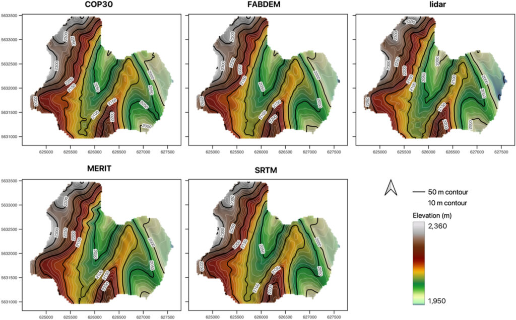
This multi-source data provides a single source of information for those who need to define ground elevations, anywhere in the world. Validation published in Environmental Research Communications showed the data underpinning FABDEM is more accurate than other available global DEMs. Further validation has been conducted by independent scientists, who ranked FABDEM as the best 1 arcsecond global DEM.
In addition, when compared with other global DEMs, FABDEM’s finer spatial resolution allows smaller topographic features such as narrow flow pathways to be represented, making it a critical component within GIS, digital twin projects, engineering, infrastructure planning, modeling natural perils and earthworks.
Discover where Fathom’s terrain data sits in our full Product Stack
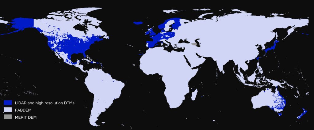
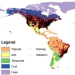
Coverage of FABDEM+ globally
By combining FABDEM with available LiDAR, Fathom offers the entire world at 30 meter resolution, with 10 meter resolution data available in regions where enhanced data exists.
Over 30 countries benefit from LiDAR within the digital terrain model (DTM), though at varying degrees of coverage. In total LiDAR comprises over 10 million km². Where LiDAR is unavailable, FABDEM fills in the gaps.
LiDAR is focused in regions of high population and covers more than 90% of the population in many countries including Hong Kong, Japan and New Zealand.
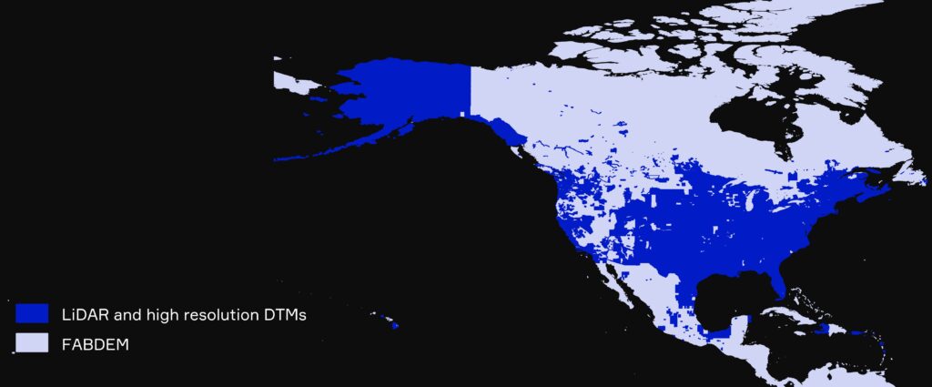
Coverage of FABDEM+ in North America
LiDAR available within FABDEM+ covers 90% of the population in US and Canada.
For the US specifically, 79% of lower land area is covered by LiDAR, which includes 94% of buildings.
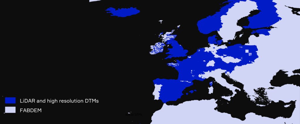
Coverage of FABDEM+ in Europe
FABDEM+ comprises enhanced LiDAR data for >20 European countries.
Across the countries represented, LiDAR covers ~90% of the total population.
Where LiDAR is unavailable, Fathom uses data from its digital terrain model, FABDEM.
Accessing Global Terrain Data

Fathom API
Gain seamless access to Fathom’s entire Global Terrain Data or select a specific region using our cloud-based API.

Fathom Portal
Visualize the data via Fathom’s interactive in-house platform. If you are interested in this solution, you can trial the platform using Fathom sample data for free. Request a demo here.

Direct provision
Integrate your terrain data with your internal systems and host the data on-site, through the provision of GeoTIFF files.

Partner
Fathom’s data can seamlessly integrate with a wide range of third party platforms. Get in touch to enquire about a platform or learn more about our existing partners here.
Recent research
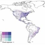
Urbanizing the floodplain: global changes of imperviousness in flood-prone areas
Assessing flooding impact to riverine bridges: an integrated analysis
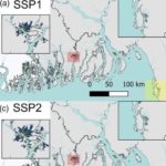
Increased population exposure to Amphan-scale cyclones under future climates
Flood Inundation Prediction
Design flood estimation for global river networks based on machine learning models
An assessment of large-scale flood modelling based on LiDAR data