-
Collings, T.,
-
Murphy-Barltrop, C.,
-
Murphy, C.,
-

-
-


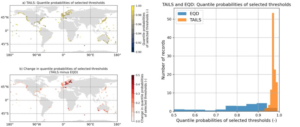
A new method, TAILS, sharpens how we identify extreme events by focusing on the most critical data, giving clearer, more reliable estimates of future coastal hazards worldwide.
Selecting a threshold to determine when an event can be considered extreme is a difficult but important process. Some studies use an arbitrary threshold, while others have tried to develop automated methods for selecting a threshold. The authors (listed above) of this study build on an existing method to present a novel approach to threshold selection: TAILS.
Whilst testing an established method developed by Murphy et al., (2024), lead author Tom Collings noticed that, when assessing the model fits of the exceedances over the selected thresholds, the results failed to accurately estimate return levels of some key locations. This got him thinking, could this method be improved to better capture the processes and locations we really care about?
The research: avoiding bias and focusing threshold selection
Taking the existing method, the authors applied two key innovations. Firstly, they edited the method to avoid introducing a bias against testing higher thresholds. This prevents low thresholds being preferentially selected, despite not validating well with observations. Secondly, they limited the number of observations that is used to evaluate the model fits of the exceedances over the threshold. This focuses the threshold selection to prioritize thresholds that give good fits with the extreme tail of the observed data.
They test the method on the GESLA global tide gauge dataset, and show that their novel approach improves the model fits of the exceedances over the selected thresholds, compared to the original approach and an arbitrary threshold, the 98th quantile.
Key findings: a better estimate of extreme tail behavior
This approach intuitively makes sense. When fitting models to observed data, we are doing so to estimate the extreme tail behavior. By the very nature of the method, we are selecting a threshold which provides a model fit which characterizes the observed tail well, therefore providing a better estimate of the extreme tail behavior. This enables more accurate estimation of extreme sea levels around the world, allowing stakeholders to better understand and prepare for extreme events that might occur in the future.
We hope that the method can be widely used to better estimate the intensities and frequencies of other natural hazards. The code has been written in such a way as to make it easily accessible and easily parallelized so as to encourage uptake from fellow researchers.

Automated tail-informed threshold selection for extreme coastal sea levels
A new method, TAILS, sharpens how we identify extreme events by focusing on the most critical data, giving clearer, more reliable estimates of future coastal hazards worldwide.
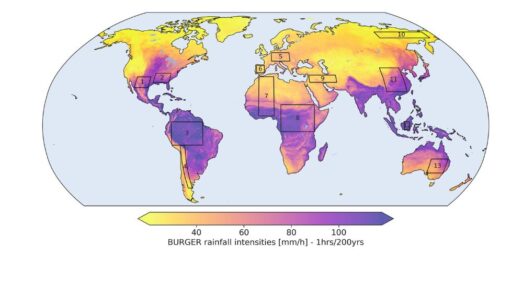
Introducing BURGER, Fathom’s new extreme rainfall dataset
New research by Fathom’s Senior Hydrologist, Dr Jannis Hoch, and other Fathom scientists describes Fathom’s new dataset, Bottom Up Regionalised Global Extreme Rainfall, or BURGER for short. It’s the first of its kind to be created from rainfall gauge data and the first to contain extreme estimates for durations as short as an hour.
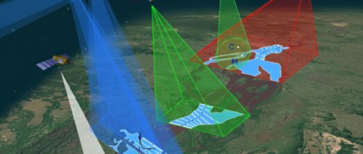
Satellite Requirements to Capture Water Propagation in Earth’s Rivers
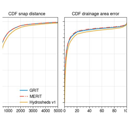
Global River Topology (GRIT): A bifurcating river hydrography
Researchers have created the first branching global river network that represents bifurcations, multi-threaded channels and canals.

FathomDEM Global Terrain Map
A new research paper published in Environmental Research Letters outlines the creation of FathomDEM, a new global 30 m DEM produced using a novel machine-learning approach.