-
Archer, L.,
-

-
-
Vosper, E.,
-
Carroll, D.,
-
Sosa, J.,
-
Mitchell, D.


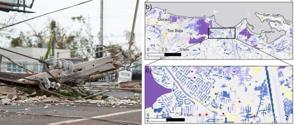
Hurricane-related floods are a major threat to Puerto Rico, but there have been few studies to understand flood risk in small islands under climate change. This research addresses this gap.
In September 2017, a tropical cyclone named Hurricane Maria led to a humanitarian crisis in the northeastern Caribbean, particularly on the island of Puerto Rico where it caused 2,975 fatalities.
The catastrophic event brought into sharp focus the threat that Puerto Rico and other Small Island Developing States (SIDS) are under from tropical cyclones – a threat that is expected to grow under climate change.
These island nations were a major driving force in the adoption of the Paris Agreement of 2015, which aimed to limit global warming to well below 2 ∘C above pre-industrial levels and, if possible, to 1.5 ∘C.
The difference between the 1.5 ∘C and 2 ∘C goals could be critical for SIDS, yet there is little research into how changes in tropical cyclones under climate change will affect flood risk in these islands. The authors of this new research paper set out to fill this gap, developing new methodologies for modeling rainfall-driven flooding in Puerto Rico under current climate conditions and at the 1.5 ∘C and 2 ∘C Paris Agreement goals. It is understood to be the first event-based assessment of flood hazard on a small island under current and future climate change.
The research: A step-change in modeling rainfall-driven flood in small islands
Traditionally, flood modeling of small islands assumes a uniform rainfall intensity in time and space based on historical data. However, this method doesn’t fully capture the complexities of flooding and how it might change over time. An “event set approach”, which uses synthetic rainfall events with realistic spatial patterns to model floods, can produce more accurate results but the data needed for this method is scarce, especially for small islands.
To address this problem, the researchers used a synthetic hurricane rainfall dataset simulator as an input to an event-based hydrodynamic model to estimate floods in Puerto Rico. The aim was to explore two key questions:
- What is the current rainfall-driven flood hazard and population exposure associated with hurricanes in Puerto Rico, with an emphasis on low-magnitude, high-frequency events (< 30-year return period)?
- How does population exposure to flooding change from the present day to 1.5 and 2 ∘C climate change scenarios?
Results: Population exposure to flood will increase
Three key findings of this research were:
- Approximately 8 %–10 % of the population is currently exposed to flooding from hurricane rainfall at the five-year recurrence interval in Puerto Rico.
- The estimated area at risk of flooding in a 20-year return period event will increase even under the 1.5 ∘C global warming scenario.
- The population exposure to flooding from hurricane rainfall-driven flooding in Puerto Rico is likely to increase under both 1.5 and 2 ∘C of global warming.
The results underscore the extent of the risk that climate change poses to Small Island Developing States, even under the more ambitious – and least likely to be achieved – goal of 1.5 ∘C. It also highlights the urgent need for large-scale mitigation and adaptation efforts in the region.
To find out more about this research, download the full paper from Natural Hazards and Earth Systems Sciences

Automated tail-informed threshold selection for extreme coastal sea levels
A new method, TAILS, sharpens how we identify extreme events by focusing on the most critical data, giving clearer, more reliable estimates of future coastal hazards worldwide.
Introducing BURGER, Fathom’s new extreme rainfall dataset
New research by Fathom’s Senior Hydrologist, Dr Jannis Hoch, and other Fathom scientists describes Fathom’s new dataset, Bottom Up Regionalised Global Extreme Rainfall, or BURGER for short. It’s the first of its kind to be created from rainfall gauge data and the first to contain extreme estimates for durations as short as an hour.
Satellite Requirements to Capture Water Propagation in Earth’s Rivers
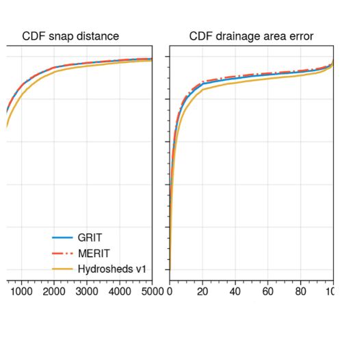
Global River Topology (GRIT): A bifurcating river hydrography
Researchers have created the first branching global river network that represents bifurcations, multi-threaded channels and canals.

FathomDEM Global Terrain Map
A new research paper published in Environmental Research Letters outlines the creation of FathomDEM, a new global 30 m DEM produced using a novel machine-learning approach.