-
Gutenson, J.,
-
Tavakoly, A.,
-
Islam, M.,
-

-
Lehman, W.,
-
Hamilton, C.,
-
Wahl, M.,
-
Massey, T.

New research shows the wide spread in flood impacts simulated by different modeling approaches.
New research from Gutenson, J. L. and others, including Fathom’s Chief Research Officer Dr Oliver Wing, compares the estimated impact and exposure to flooding generated by different event-based flood inundation maps.
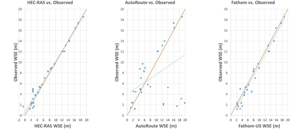
Flood inundation maps (FIMs) provide essential information to emergency management during flood events. There are a number of different frameworks capable of estimating FIMs during compound coastal flood events. Using Hurricane Harvey as an example event, the research focused on a small coastal watershed in Texas.
The team evaluated three FIMs derived from these frameworks. This research evaluated HEC-RAS, AutoRoute and Fathom-US models. The research compared Fathom’s simulations of this event with detailed local HEC-RAS models as well as more simplified approaches (such as HAND).
These FIMs were evaluated using a two-layer analysis; assessing the locational accuracy for each FIM and a comparison of exposure and consequence estimates from each FIM.
Their analysis shows that each of the three different FIM frameworks provided not only different levels of accuracy, but also produced different exposure and consequence estimations due to spatial differences. Though the findings show that no one FIM is perfect in its estimations (as each is subject to its own uncertainties present from the model’s numerical scheme, inputs and configuration) Fathom’s US model and the detailed models show similarly high correspondence to benchmark data, while the simple approach was subject to considerable error. By using a multi-model approach to evaluating the impacts of flood events before, during and after they happen, users can increase their confidence in modeled results and more easily identify areas where error might exist.
This study highlights the need to rectify and adjudicate the various FIMs created during flood events. In response to this need the Integrated Water Resources Science and Services (IWRSS) consortium has set out operational plans for coordinating FIM production through the Integrated Flood Inundation Mapping (iFIM) effort (Mason et al., 2020).
Related research

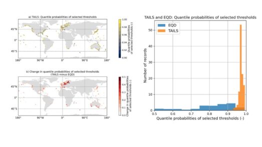
Automated tail-informed threshold selection for extreme coastal sea levels
A new method, TAILS, sharpens how we identify extreme events by focusing on the most critical data, giving clearer, more reliable estimates of future coastal hazards worldwide.
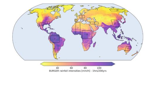
Introducing BURGER, Fathom’s new extreme rainfall dataset
New research by Fathom’s Senior Hydrologist, Dr Jannis Hoch, and other Fathom scientists describes Fathom’s new dataset, Bottom Up Regionalised Global Extreme Rainfall, or BURGER for short. It’s the first of its kind to be created from rainfall gauge data and the first to contain extreme estimates for durations as short as an hour.
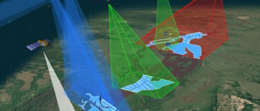
Satellite Requirements to Capture Water Propagation in Earth’s Rivers
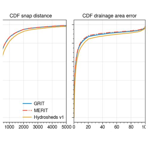
Global River Topology (GRIT): A bifurcating river hydrography
Researchers have created the first branching global river network that represents bifurcations, multi-threaded channels and canals.

FathomDEM Global Terrain Map
A new research paper published in Environmental Research Letters outlines the creation of FathomDEM, a new global 30 m DEM produced using a novel machine-learning approach.