
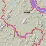
World Bank – International financial institution
Unique global partnership, the World Bank, use Fathom’s model outputs to validate reported flood events on the ground.
They are five financial institutions working for sustainable solutions that reduce poverty and build shared prosperity in developing countries. There is a need to provide a measure of confidence in the reported impacts on the ground from flood events
The solution
Fathom’s model outputs assisted the rapid impact assessment team in confirming that the order of magnitude of the (direct) damage reported per province conforms with the order of magnitude reported by the model.
The results
As the damage assessment on the ground is done in a very short timeframe, it is extremely useful to have the damage looked at from a different perspective
The World Bank gained outputs from Fathom’s Global Flood Map. By leveraging this global dataset, the World Bank reported increased confidence in the rapid damage assessment results undertaken on the ground; as well as used the data to detect some discrepancies in provinces outside the study.
Related research
Hyper-resolution PCR-GLOBWB: opportunities and challenges from refining model spatial resolution to 1 km over the European continent

Urbanizing the floodplain: global changes of imperviousness in flood-prone areas
Increased population exposure to Amphan-scale cyclones under future climates
Flood Inundation Prediction
Design flood estimation for global river networks based on machine learning models
An assessment of large-scale flood modelling based on LiDAR data
In 2024, Fathom now offers its flood data for non-commercial use, free of charge, to 16 countries under a new agreement with the World Bank.
Related case studies

The Nature Conservancy
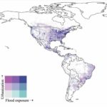
The Nature Conservancy worked with Fathom to understand flood risk and identify large scale exposure to flooding across different demographics and the impact of future climate scenarios.
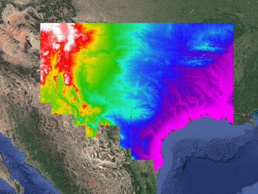
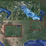
Texas Water Development Board
Texas Water Development Board uses Fathom data, and others, to accelerate the development of the first statewide flood planning program in the absence of publicly available flood data.
Arup & World Bank
Fathom & Arup demonstrate how rapid, data-driven flood modeling can quantify the impact of urban greening on flood extent, soil erosion, and urban heat. Discover how NBS can create more resilient cities.


Bank of England
Fathom supported the Bank of England in their analysis of submissions for CBES 2021 using the Fathom-UK CAT model.
Quote We would like to express our gratitude to both the physical risk open data providers as well as to the plethora of technical experts for all of their contributions to this exercise over the past two years.