


One of the key drivers of increasing flood risk is the development of urban areas near rivers and coasts.
Paired with climate change and a growing population, consequential exposure continues to grow.
New research led by Kostas Andreadis in Environmental Research Letters asks: have floodplains become more built-up over time? And if so, by how much?
Using data from Fathom-Global 2.0, researchers find that – in only 30 years – the footprint of urban areas within floodplains globally has doubled.
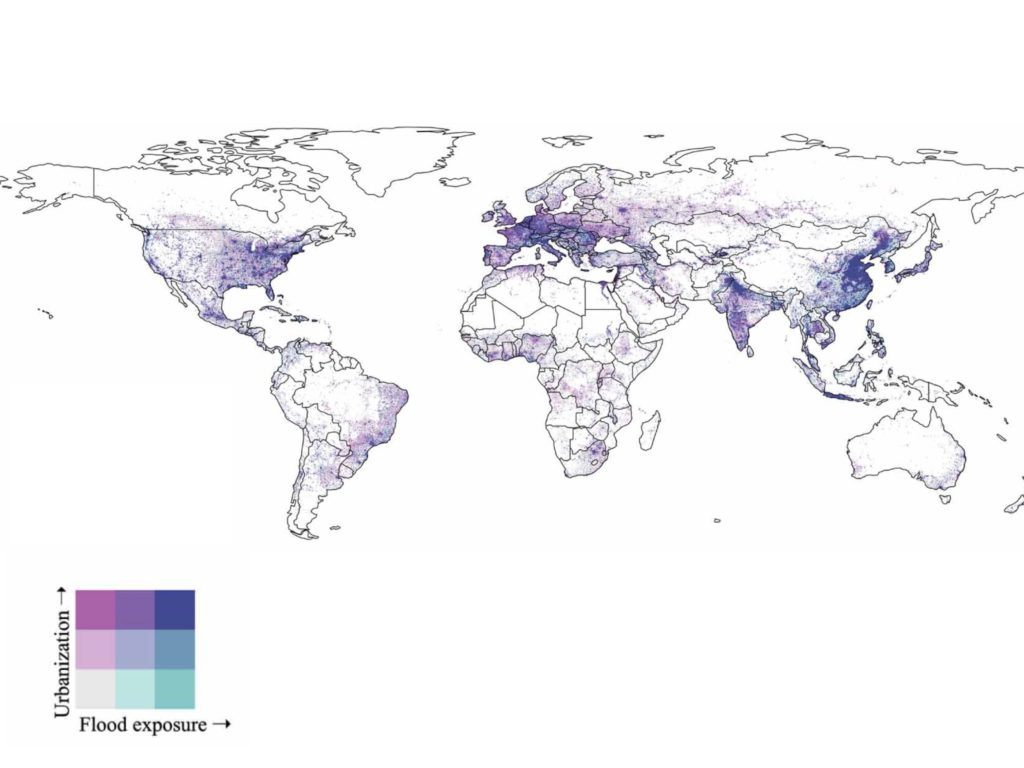

More so, they also find that urbanisation rates were highest in the most hazardous areas of floodplains and encroachment is accelerating with time.
Fundamentally, this shows that while many factors contribute to increasing flood risk, continued development of floodplains is one of the most certain and significant drivers of flood losses.