-
Chone, G.,
-
Biron, P.,
-
Buffin-Bélanger, T.,
-
Mazgareanu, I.,
-

-


In this paper we collaborated with colleagues at the University of Concordia to demonstrate the value of bathymetry estimation in large scale model frameworks by testing across four watersheds in Quebec, Canada.
Large-scale flood modelling approaches designed for regional to continental scales usually rely on relatively simple assumptions to represent the potentially highly complex river bathymetry at the watershed scale based on digital elevation models (DEMs) with a resolution in the range of 25–30 m.
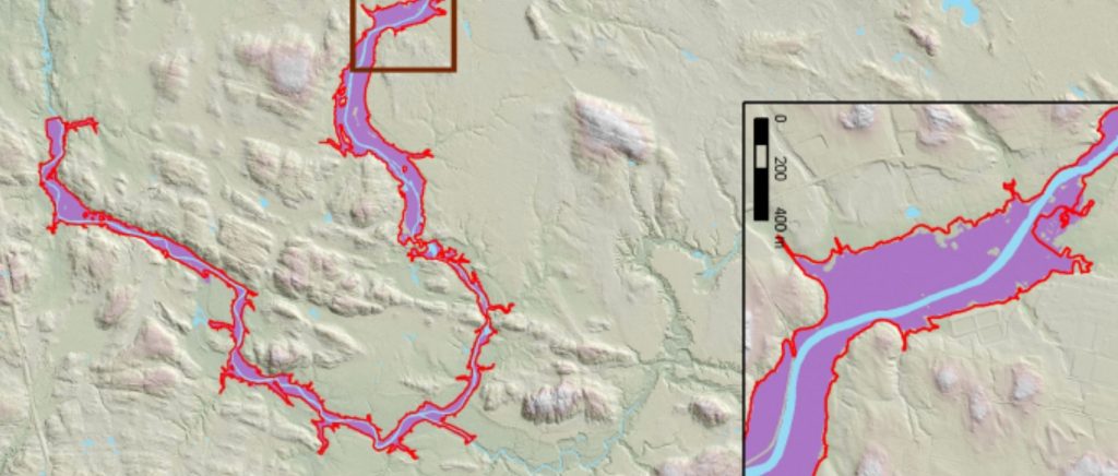
Here, high-resolution (1 m) LiDAR DEMs are employed to present a novel large-scale methodology using a more realistic estimation of bathymetry based on hydrogeomorphological GIS tools to extract water surface slope. The large-scale 1D/2D flood model LISFLOOD-FP is applied to validate the simulated flood levels using detailed water level data in four different watersheds in Quebec (Canada), including continuous profiles over extensive distances measured with the HydroBall technology.
A GIS-automated procedure allows to obtain the average width required to run LISFLOOD-FP. The GIS-automated procedure to estimate bathymetry from LiDAR water surface data uses a hydraulic inverse problem based on discharge at the time of acquisition of LiDAR data. A tiling approach, allowing several small independent hydraulic simulations to cover an entire watershed, greatly improves processing time to simulate large watersheds with a 10-m resampled LiDAR DEM. Results show significant improvements to large-scale flood modelling at the watershed scale with standard deviation in the range of 0.30 m and an average fit of around 90%. The main advantage of the proposed approach is to avoid the need to collect expensive bathymetry data to efficiently and accurately simulate flood levels over extensive areas.