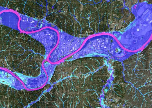
This month, we saw widespread coverage for our partnership with First Street Foundation around the release of Flood Factor – the first openly available and comprehensive flood data for the US.
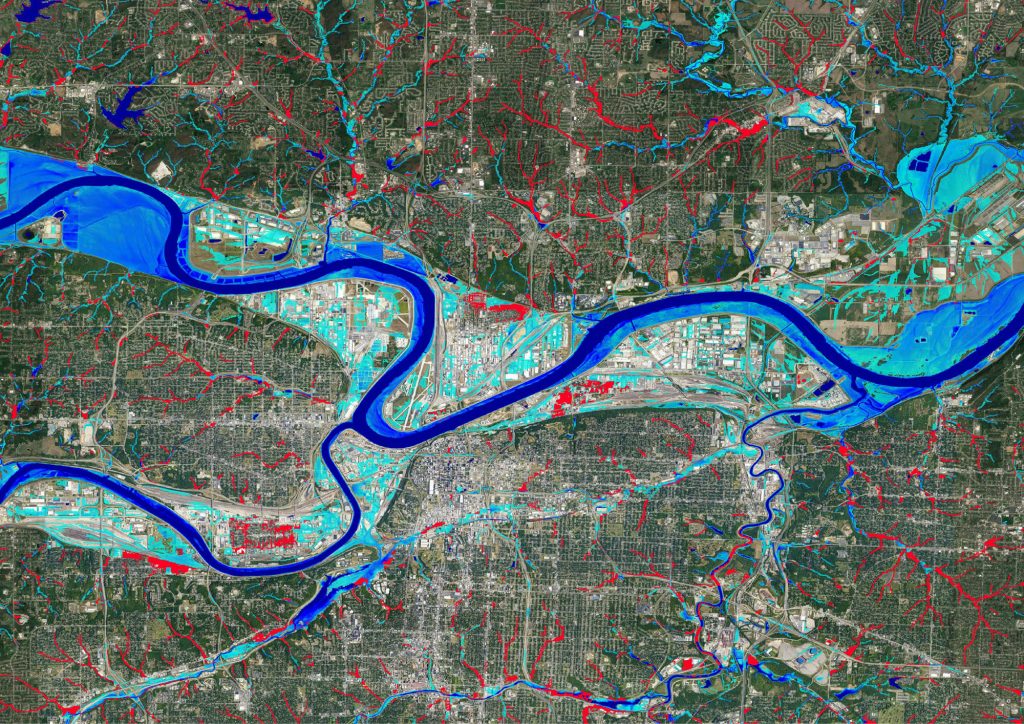
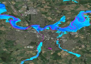
Nearly six million properties across the US have a substantial risk of flooding that isn’t disclosed by federal flood maps, but the new data – built using Fathom’s US 2.0 model – is a virtually unprecedented disclosure of potentially how much damage climate change can cause to people’s homes through flooding.
Focusing on the importance of measuring flooding in the context of climate change, Bloomberg ran an extensive feature on the impact the new tool would make to American homeowners who can now instantly see the flood risk of their property.
We were equally proud to be recognised in the Washington Post alongside some fantastic academic institutions as the science powering this tool which is democratising flood data across the US.
Additional coverage included The New York Times and CNN which highlighted the hidden risk of flooding to inland cities and poorer areas by the coast, as well as the Wall Street Journal and Scientific American which both drew attention to the 6 millions homes whose flood risk hadn’t been disclosed by the FEMA’s maps. Reuters, Florida Today and the Miami Herald also ran the story.
It is great to see that our latest US flood model is not only enabling insurers but also US citizens to confidently understand flood risk moving forward and put in place the appropriate mitigation measures to protect their homes.
Update 2023: Discover Fathom’s new US Flood Map
New for 2023, find out more about the most complete and technologically advanced flood map for the United States to date.
What is Fathom US 2.0?
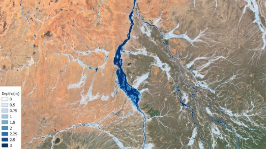
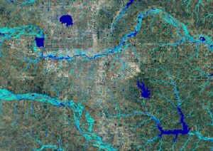
The Fathom-US 2.0 Flood Hazard Data provides a comprehensive view of flood hazard throughout the United States.
Fathom-US 2.0’s detailed coverage of fluvial and pluvial flooding includes 100% of the contiguous US, which fills in gaps from FEMA data which covers just 60% of the contiguous US.
Fluvial Models
For fluvial flood modelling, Fathom US 2.0 explicitly represents river channels of all sizes, at a 10m resolution. This also includes a comprehensive representation of flood defences.
Pluvial Models
Fathom US 2.0 represents forecasts of pluvial flash-flooding throughout the US. Importantly channel drainage is represented explicitly, and flood events can be simulated for flow pathways of all sizes.
Extreme precipitation magnitudes that form our pluvial models are taken from NOAA (National Oceanic and Atmospheric Administration).