Cyclone Emnati, Madagascar 2022

Tropical Cyclone Emnati is the fourth tropical cyclone to make landfall on Madagascar in five weeks
Event start
21st February (estimated gusts reaching 140mph)Date of forecast
20.2.2022Report issuing date
21st February 2022


Today Tropical Cyclone Emnati made landfall across the east coast of Madagascar
The storm will bring intense winds (estimated 115 mph winds and 130-140 mph gusts) and heavy rainfall. Classified as a category 3 cyclone, Emnati is forecasted to take the same journey as Storm Batsirai which hit the region one week earlier.
In collaboration with partners, Fathom has produced a pre-event weather forecast that will inform event response from the FCDO.
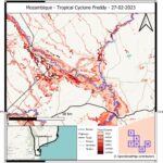
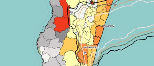
The emergency bulletin, issued on 21st February, predicts that southeast Madagascar will experience rainfall totals >150mm during the 22nd and 23rd of February, with heavily impacted areas potentially receiving up to 600mm of rain during this period.
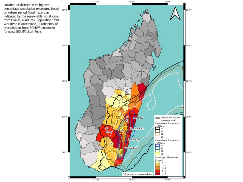
Regions of Madagascar with the highest exposure to flooding include:
Vatovavy-Fitovinany Region
Exposure estimate: ~92,000
Most at-risk districts: Manakara-Sud; Mananjary; Vohipeno, Nosy Varika
~570,000 in current acute food insecurity.
Atsimo-Atsinana Region
Exposure estimate: ~54,000
Most at-risk districts: Farafangana; Vangaindrano
~825,000 in current acute food insecurity.
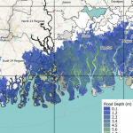
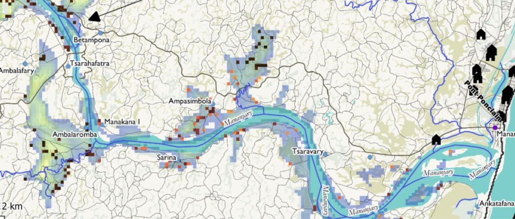
Researchers working on this bulletin have estimated that most flood risk will come from pluvial and fluvial flooding (in excess of a 1-in-20 year flood) driven by heavy rainfall.
Whilst surge will be a minor contributor to overall risk and exposure, the report also analyses coastal flooding. To produce these forecasts, researchers have used data derived from FABDEM and WorldPop.
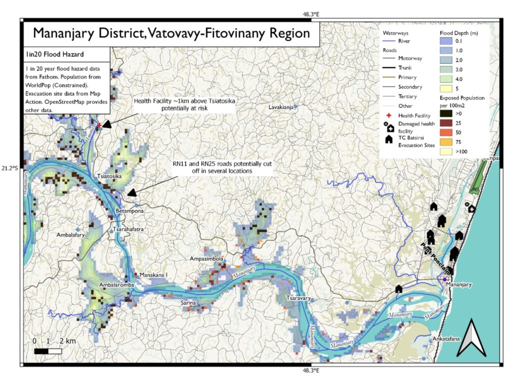
These data have identified several low-lying districts that may be at risk of storm-surge related flooding. Impacted regions include Nosy Varika, Mahanroro, Mananjary and Manakara-Sud.
This month, Fathom has also produced an emergency bulletin in response to Cyclone Batsiarai. You can read about this here.
More response reports