
How do you measure the benefits of using nature-based solutions (NBS) to prevent flooding? In this Engineering Matters podcast episode, Fathomers Anthony Cooper, Dr Natalie Lord and Gavin Lewis and Arup’s Caroline Ray discuss the joint Arup-Fathom collaboration on a project to future-proof the city of Dar es Salaam.
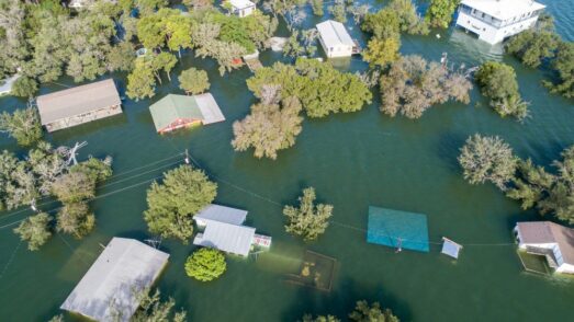
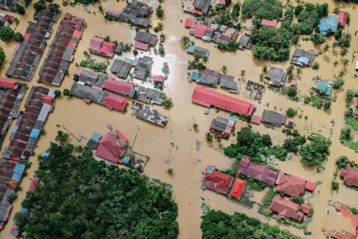
Dar es Salaam is the largest city in Tanzania and one of the fastest-growing in the world. This rapid growth and urbanization, coupled with its low-lying, coastal position, makes the city particularly vulnerable to flooding, water scarcity, soil erosion and other climate-change-related problems.
Collaborating with the Government of Tanzania and the World Bank, Arup was selected to support a project looking at how the city could be future-proofed against the evolving risk of climate change, with a particular focus on how nature-based solutions would prevent flooding, disease and urban heating.
This work was financed by the Tanzania Urban Resilience Program, a UK Foreign Commonwealth and Development Office funded programme delivered by the World Bank, and the Quality Infrastructure Investment Partnership – financed by the Government of Japan.
Arup’s role was to help local planners understand how different types of green solutions could be used, what their impact would be on each area, and the cumulative impact on the city as a whole. To do this, they needed a detailed flood map of the city, which is where Fathom came in.
Modeling floods under climate change
In the podcast, the Fathom team talks about the science behind modeling floods under multiple climate scenarios. Head of Engineering Gavin Lewis explains:
“We have selected a whole range of global climate ensembles and from that we develop a range of change factors that we apply to our current view of flooding. That allows us to [model] different climate scenarios, different emission scenarios and time horizons between now and 2100, and give a detailed understanding of flood risk anywhere in the world.”
Dr Natalie Lord, Principal Climate Scientist at Fathom, tells us more about change factors:
“A change factor is essentially the relative change in a variable that we’re interested in. So it might be extreme precipitation, for example. We look at the extreme precipitation that the models project for a historical time period and then at how that changes for a future time period. We then apply that relative change to our historical baseline view of flooding.”
To hear more from Dr Natalie Lord on how Fathom models the impacts of climate change on a global scale, catch up with our CPD-accredited session on the topic.
Speeding up the process with automation
Automation also plays an important role in Fathom’s Global Flood Map, and it was one of the reasons the team were able to iterate different urbanization and climate scenarios so rapidly. As Anthony Cooper, Senior Hydraulic Model Developer at Fathom, explains:
“Our main focus generally is building our global flood maps. And that’s not something you can do manually, taking a map of rivers and putting them all together. There’s just too much of the globe to do that on. So we have developed an automation framework to build these models.
“Some of the things that we were looking at, particularly urbanization, were a bit of a new one for us. So we had to think about exactly how that would go into our model and what the impacts would be. Because urbanization by itself – just there being more houses – doesn’t necessarily have an impact on flood risk.”
Considering the ‘what ifs’
Caroline Ray, Arup’s Regional Director for East Africa, gives more context on Dar es Salaam and the needs of the project, detailing how the project involved rapid ‘optioneering’ i.e generating many iterations to answer the ‘what ifs’:
“We developed the climate change scenarios together and tried to understand what that means in terms of changes in rainfall intensity. Fathom carried out the modeling of the floods for those different future scenarios. And we then overlaid the flood maps with maps of the future city to start asking, ‘what’s the difference, both with and without those urban greening solutions implemented?’”
By taking this innovative approach and generating results at top-speed, the team were able to meet the project’s short deadlines and share valuable insights with the client, as Caroline notes:
“The real output is the maps and then there’s a catalog of urban greening solutions and guidance on which land-use types are most suited to which nature-based solutions… The hope is dissemination of the importance of urban greening plus some of the ideas about what could be applied where, will inform future policies and regulations for implementation as the city grows.”

Measuring the impact of nature-based solutions
Fathom teamed up with Arup to demonstrate how urban greening can alleviate flood risk in Dar es Salaam with rapid bespoke modeling. Learn more by reading the case study in full.
Quote Fathom’s most recent release – Fathom-Global 3.0 – provides flood maps for anywhere in the world, and at improved levels of detail, providing information to help decision makers better manage their future flood risk by considering climate change and the associated uncertainty.
Read Case Study