
Fathom’s involvement and inclusion in a report presented to US Congress
In September 2023, the US Congressional Budget Office (CBO) issued a report to the US Congress entitled ‘Communities at Risk of Flooding’.
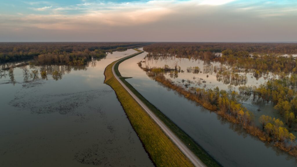
The report explores how projected flood risk varies across communities in the United States, with differing economic and demographic characteristics (such as median household income, race, homeowner status and more). It focuses on the years 2020 and 2050 to assess flood risk under both current and future conditions, and also evaluates whether flood risk is greater for inland or coastal communities.
We at Fathom welcome this report; multiple pieces of our research are referenced and fed into its conclusions, and I am pleased to have been involved as an external reviewer. With climate change contributing to a rise in flood risk, it is crucial that we better understand how different communities may be affected in the future.
What is the CBO?
The United States Congressional Budget Office – CBO – has a mandate to provide objective, impartial economic analysis to the United States Congress to inform decision-making. This report – ‘Communities at Risk of Flooding’ – was prepared at the request of the Ranking Member of the US House Committee on the Budget. In keeping with the CBO’s non-partisanship, the report does not make recommendations, and instead presents independent analysis and information to support the Congressional budgetary process.
Key findings Key findings of the CBO report: Communities at Risk of Flooding
The report finds flood risk to be 9% in 2020 – which translates to 9% of properties facing at least a 1% annual probability of experiencing a depth of approximately 1 foot or more in flooding (in practice, this kind of annual probability is equivalent to about a one-in-four chance of experiencing such a flood in a 30-year period, says the CBO). In the 2050 projection period, this risk climbs to 10%.
According to the report, flood risk varies with community characteristics across:
Median household income:
Communities with a lower median household income experience greater flood risk. The exception to this is communities where most householders are Hispanic or Latino, which instead see a lower prevalence of flood risk when median household income is lower.
Race
More White householders in a community translates to a greater risk, but communities with mostly Black householders – bar those with a high median household income – are set to see the largest flood risk increases to 2050.
Ethnicity
Communities with a greater share of Hispanic or Latino householders see fewer properties exposed to flood risk.
Type of residence
When residences are mostly secondary dwellings, communities see far more prevalent risk than those with mostly primary residences (and this difference is greater in coastal than inland areas). Where large proportions of residents are renters, flood risk is lower.
Composition of household
Communities with a greater share of households with members aged 65+ face greater flood risk, while risk is lower where a greater share of households have children.
Geographic location
Properties in coastal communities are exposed to more than twice the flood risk of inland communities. These coastal communities will also see a greater increase in projected flood risk from 2020 to 2050. Of all communities analyzed in this report, the highest percentage of properties exposed to flood risk is found in coastal communities where most of the dwellings are secondary residences.
The report warns that no causation can be defined for these variations due to the nature of available data. Relevant factors to this variation could also include motivations for moving and settling, and the extent to which local governments invest in adaptive infrastructure.
The projected flood risk across communities was measured and compared using two methods:
- One: by grouping communities into fifths (quintiles) according to the distribution of households with a given characteristic.
- Two: by grouping communities according to the characteristics shared by most households within that community.
Risk was projected for properties – not households or householders – in all cases.
Fathom’s research within the CBO report
The report references research from Fathom on the uncertain nature of projecting and modeling flood risk.
Firstly, the CBO report references a Fathom-led study on present and future rainfall-driven flood risk in the United States – specifically, the study’s supplementary data on ‘Uncertainty in Hazard Estimation’. According to this paper, given that flood patterns are so strongly influenced by topography, much of the uncertainty inherent in flood modeling is associated with the uncertainties inherent in our terrain data.
Secondly, the report references a Fathom-led paper presenting enhanced analysis of United States flood hazard (fluvial, pluvial and coastal) at a spatial resolution of 30 meters, with updated hydrography data, channel depth determination, flood frequency analysis, consideration of how local interventions affect flooding, and, most relevantly for the CBO report, output downscaling to useful levels for individual property tracts.
This paper offers the “first comprehensive and consistent national-scale analysis of flood hazard for the conterminous United States for both current and future conditions”, and projects clear patterns of changing flood hazard across land areas where human use is possible, or land that is currently protected but may become less so with time.
The CBO report references a third Fathom-led paper, with a particular focus on section 3.5 on land use in relation to the development of a 30-meter-resolution hydrodynamical model of the US based on public data. This model simulates fluvial and pluvial flooding in, respectively, catchments down to 50 square kilometers and in all catchments. It acts as a demonstration of the value of continental-scale models to support some decision-making needs, rather than approaches based on a patchwork of local studies.
The CBO report notes this study’s discussion on the difficulty of hydraulic modeling in urban areas in particular; these regions often have complex flow paths that require models to account for micro-scale features such as curbs and walls. Continental models struggle to represent these accurately – for example, to model the difference in elevation between a building and a road – as they are limited in horizontal accuracy. Rather than smoothing over small-scale features and representing urban areas in an overly simplified way, modelers instead often strip away all buildings to produce so-called ‘bare earth’ digital elevation models; however, it should be considered that these may ignore potentially critical surface objects when determining flood flow paths.
Interested in bare earth global terrain data? Discover FABDEM+ – The new standard for a globally consistent and accurate digital elevation model
Discover the latest published research papers from Fathom’s team
Learn more about inequitable flood risk
Dr Oliver Wing has featured in articles by The Conversation, CNN, ABC News and The Washington Post discussing his research on the inequitable nature of flood risk. Check these out to learn more.
