Japan Flood Map
Building on an extensive network of river gauges and flood defences
Fathom’s Japan Flood Map, Fathom-Japan, signals the next generation of flood data for Japan, applying unique algorithms, alongside leading modeling techniques and research. A rich body of high-quality observational data combined with the latest climate data, results in a sophisticated model that can provide confident estimations of present and future risk.
Key features of Fathom’s Japan Flood Map
~10-meter resolution
Incorporates the latest LiDAR data, in addition to other terrain and hydrography datasets
Climate Dynamics
3 time horizons – Utilising D4PDF ensemble of climate models to produce updated 2020, 2035 and 2050 climate states
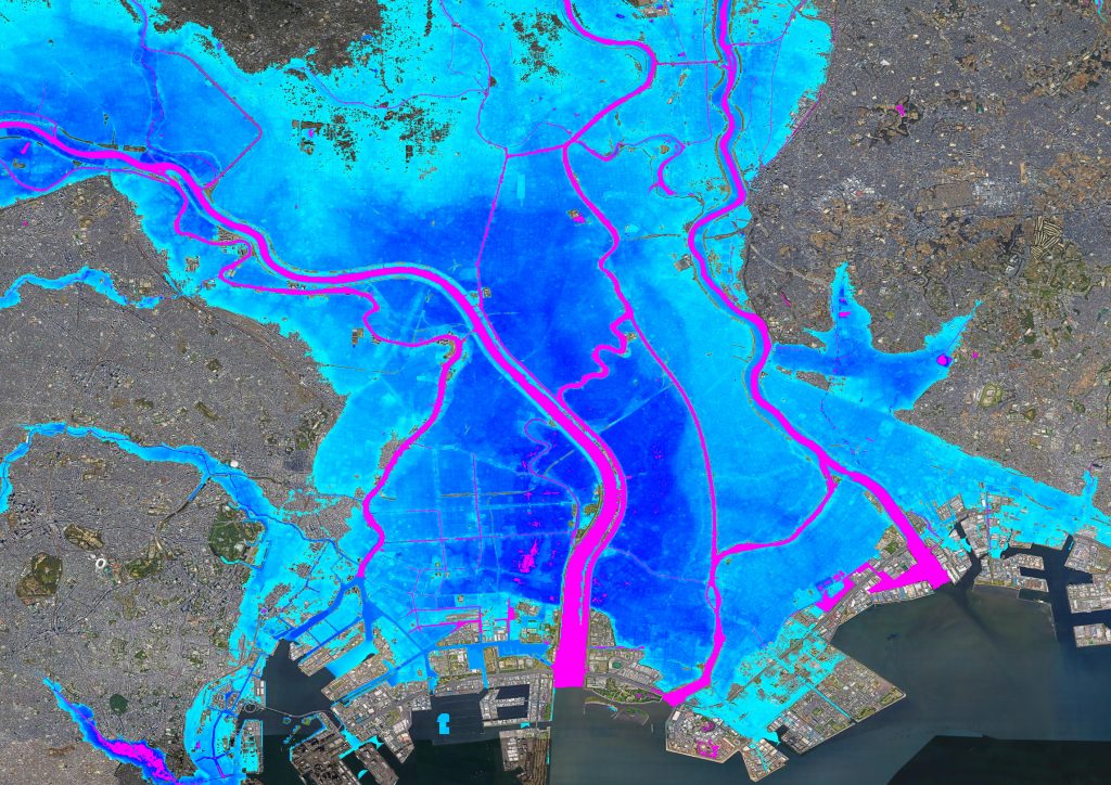
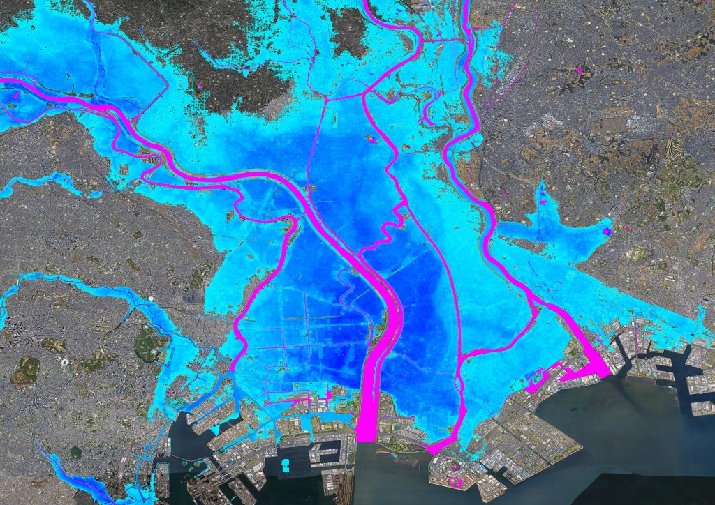
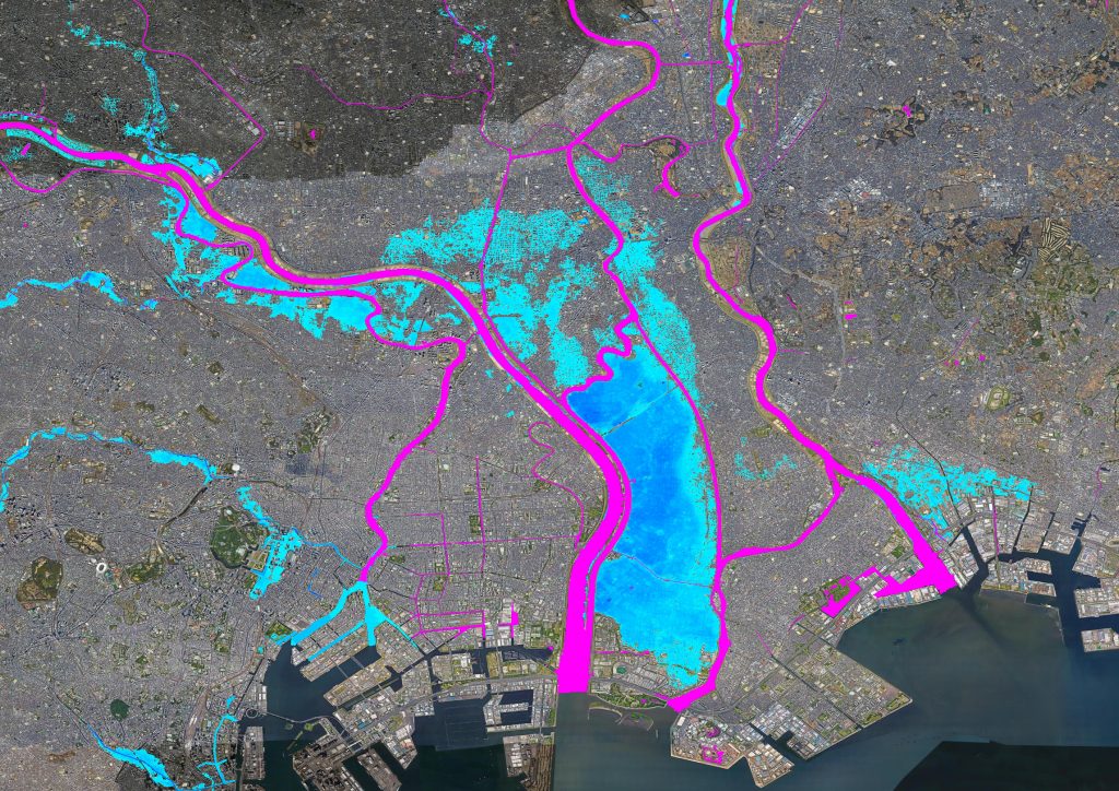
Inland & coastal
Fluvial, pluvial and coastal flooding – Assess the risk from different types of flood including defended and undefended views
Return periods
11 return periods – ranging from 1 to5 year to 1 to 2500 year. Return periods can be categorized to suit your risk appetite
Access
Gain instant on-demand access via the Fathom API and Fathom Portal, or host the data on-premise
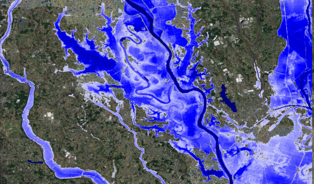
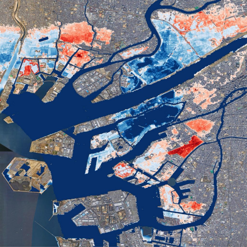
About the map Mapping river channels in Japan Flood Map
Japan possesses one of the most complex river infrastructures in the world, owing to a combination of unique hydrology and extensive anthropogenic intervention.
Fathom represents every river channel in Japan, regardless of size and complexity.
We utilize detailed river network maps derived from Yamazaki’s Flow Direction Map (2018), a 1 arc-second national hydrology dataset developed by the University of Tokyo and Kyoto University. The dataset uses the National Elevation Dataset and the Water Map from the Geospatial Information Authority of Japan (GSI). When applying this data alongside Fathom’s dynamic solver, we are able to define channels in a much more accurate and realistic way.
Anthropogenic global warming is increasing the frequency and severity of flood events
Fathom’s Japan Flood Map produces flood hazard data for present day, 2035 and 2050 time horizons to offer users a holistic view of hazard.
These horizons have been underpinned by data from the D4PDF ensemble of climate models and simulate the 4.5 Regional Concentration Pathway (RCP) trajectory.
A 2°C warmer world steady state projection was incorporated within Japan Flood Map’s hazard layers to estimate flood hazard at 2035 and 2050.
Following analysis undertaken on Japan Flood Map’s future scenarios, our researchers estimate a 1.93°C increase in Japan’s temperature by 2050.
Research and validation of Japan Flood Map
Fathom’s Japan Flood Map benefits from an impressive portfolio of award winning research and methodologies spanning two decades.
The methodologies implemented within Fathom-Japan have undertaken extensive validation. This research, has been published in leading peer-reviewed journals and has provided continuous validation to Fathom’s unique flood modelling techniques.
Working alongside academic partners, Fathom has ensured that a broad range of expertise and data has been considered when developing Fathom-Japan. This includes the use of data from the Global Hydrodynamics Lab, which is part of the U-Tokyo Global Hydrology Group in the Institute of Industrial Science at the University of Tokyo.
Our collaboration is part of a long-standing relationship that Fathom has with researchers from the University of Tokyo, with whom they have co-authored numerous papers. You can access this research here.
Access Fathom’s Japan Flood Map
Fathom API

Fathom’s API gives customers the option for customers to access our flood maps and risk scores on-demand directly through this functionality.
Fathom Portal

If you do not have geospatial skills in house or are yet to implement a platform, Fathom’s portal is an easy to access, interactive platform that enables you to host, view and analyse data. Request a free trail here.
Direct Provision

For customers who would prefer Fathom’s data on-site, our team can provide our flood maps directly as a set of GeoTIFF files.
Partners

We have a range of partners who provide access to their flood maps via their third party platforms. You can learn more about our commercial partners here.