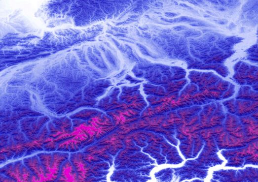
Building on the NED to produce the most accurate and complete digital terrain model of the US
Join us as we present the next evolution in US terrain data – FABDEM+. The first nationally consistent DEM that blends 3.6 million square miles of enhanced LiDAR data with FADBEM to offer the most accurate and complete digital terrain model of the US.
FABDEM+ uses FABDEM (our forests and buildings removed ‘bare-earth’ digital elevation model) to supplement areas of the National Elevation Database (NED) where the data is older or uses inferior data sources. It draws on a large library of LiDAR, including (amongst others) new LiDAR for all of Texas and extensive improvements across Florida.
Register for our on demand webinar, where we explore the US elevation data: the challenges, wider landscape and natural progression towards multi-source digital terrain models. Hear from the scientists who built FABDEM+ and explore the research and methodologies underpinning its results.
This webinar is ideal for:
- Geospatial experts: Explore the latest advancements in terrain data.
- Data scientists: Learn how FABDEM+ can enhance your data-driven projects.
- Risk officers: Discover how FABDEM+ can bolster risk mitigation strategies.
- Infrastructure planners: Uncover the benefits of accurate terrain data in your projects.
- Emergency response teams: Understand how FABDEM+ aids in disaster planning and response.
- Business leaders: Explore the corporate advantages of FABDEM+ in decision-making.
- Insurance claims: Gain efficiency and saves resources within you flood-claim lifecycle
- Cat modeling: Augment existing catastrophe models with new data, or benchmark findings and predictions from existing datasets
2026 update: Fathom releases new global terrain data, FathomDEM+
FathomDEM+ applies the latest advances in geospatial machine learning and seamlessly integrates LiDAR data to deliver the most accurate, bias-corrected global terrain model to date.