Global Flood Map
The first global flood map to provide risk professionals with all perils and climate options
Fathom’s award-winning Global Flood Map provides its users with the most robust and comprehensive set of hazard data and flood risk information in the world. Available across all major flood perils: pluvial, fluvial and coastal, it revolutionizes how insurers, financial markets, engineers, corporates and governments can understand and integrate flood hazard and climate change data into their risk operations.
Key features of Fathom’s Global Flood Map
~30-meter resolution globally
1 arcsecond data, based on FABDEM+, our latest complete map of the Earth’s terrain
Downscaled to 10-meter resolution where advanced regional data permits
Climate Dynamics
Fully flexible climate conditioned flood hazard data for any projected combination of future year and climate scenario up to 2100
Multi-peril flood layers
Fluvial, pluvial and coastal flooding – Assess the risk from major types of flood including defended and undefended views. With flood depths for return periods between 5 – 1000 years and Risk Scores (Relative Risk and Risk Category) for each type of flooding
Terrain data
Underpinned by an unparalleled Digital Elevation Model (DEM) combining FABDEM with the best available local LiDAR data
Access
Gain instant on-demand access via the Fathom API and Fathom Portal, or host the data on-premise
Metadata
Providing transparency with additional information within our maps to provide you with a better understanding of the influencing factors that may impact the certainty of flood risks, across all flood perils.
Flood map regional enhancements
- Regional Enhancements
- Global Flood Map
- No coverage
Global Flood Map
Key features
01 – ~30-meter resolution globally
02 – Climate Dynamics
Flood hazard data for any projected combination of future year and climate scenario
03 – Fluvial, pluvial and coastal flooding
04 – Terrain data
Blending FABDEM with the best available local data
05 – Access
Instant on-demand access to all of Fathom’s data
06 – Flood layers
Available as either Depths (by return periods) or Risk Scores
US Flood Map
Key features
01 – Climate Dynamics
Updated 2020 climate state
02 – 10 return periods
Ranging from 1-in-5 year to 1-in-1000 year
03 – Coverage
— Fathom covers 100% of contiguous US
— FEMA covers 60% of contiguous US
04 – Inland flooding
05 – Access
Via the Fathom API, Fathom Portal, direct provision or via a partner
06 – ~10 meter resolution
UK Flood Map
Key features
01 – Climate Dynamics
5 climate scenarios across 3 time horizons
02 – 10 return periods
Ranging from 1-in-5 year to 1-in-1000 year
03 – Defenses
Unique detection algorithm that identifies flood defenses where data are not available
04 – Inland and coastal flooding
05 – Access
Via the Fathom API, Fathom Portal, direct provision or via a partner
06 – ~10 meter resolution
Japan Flood Map
Key features
01 – ~10 meter resolution
02 –Climate Dynamics
5 climate scenarios across 3 time horizons
03 – Inland and coastal flooding
04 – 11 return periods
Ranging from 1-in-5 year to 1-in-2500 year
05 – Access
Via the Fathom API, Fathom Portal, direct provision or via a partner
05 – Defenses
Flood defenses are explicitly built-in using a new levee detection algorithm
Key features
01 – ~30-meter resolution globally
02 – Climate Dynamics
Flood hazard data for any projected combination of future year and climate scenario
03 – Fluvial, pluvial and coastal flooding
04 – Terrain data
Blending FABDEM with the best available local data
05 – Access
Instant on-demand access to all of Fathom’s data
06 – Flood layers
Available as either Depths (by return periods) or Risk Scores

Key features
01 – Climate Dynamics
Updated 2020 climate state
02 – 10 return periods
Ranging from 1-in-5 year to 1-in-1000 year
03 – Coverage
— Fathom covers 100% of contiguous US
— FEMA covers 60% of contiguous US
04 – Inland flooding
05 – Access
Via the Fathom API, Fathom Portal, direct provision or via a partner
06 – ~10 meter resolution

Key features
01 – Climate Dynamics
5 climate scenarios across 3 time horizons
02 – 10 return periods
Ranging from 1-in-5 year to 1-in-1000 year
03 – Defenses
Unique detection algorithm that identifies flood defenses where data are not available
04 – Inland and coastal flooding
05 – Access
Via the Fathom API, Fathom Portal, direct provision or via a partner
06 – ~10 meter resolution

Key features
01 – ~10 meter resolution
02 –Climate Dynamics
5 climate scenarios across 3 time horizons
03 – Inland and coastal flooding
04 – 11 return periods
Ranging from 1-in-5 year to 1-in-2500 year
05 – Access
Via the Fathom API, Fathom Portal, direct provision or via a partner
05 – Defenses
Flood defenses are explicitly built-in using a new levee detection algorithm
Quote Fathom provide a first-rate product and service based upon cutting-edge research and methodologies, which are both robust and transparent. Their flood data sets are global, consistent and high calibre. Most importantly, Fathom is a responsive and collaborative firm who consistently deliver.

Quote Highly knowledgeable presenters with genuine enthusiasm for the work they are doing. A product that can provide global impact in relation to an issue that is extremely high cost, and in a way that can be done efficiently and at scale.
Quote Climate Engine and Fathom have been in partnership for some time and our work with BMO’s Climate Institute is an example of how cutting edge flood modeling plays a key role in helping the bank and their clients mitigate risks associated with the physical impacts of climate change.

Quote Fathom’s flood hazard and risk data products are critical to assessing risks to Microsoft’s cloud infrastructure. In this way, their data impacts the delivery of services relied on by the 400 million global users of Office 365, Outlook.com and OneDrive, and the 48 million members of Xbox.
Quote Fathom’s most recent release – Fathom-Global 3.0 – provides flood maps for anywhere in the world, and at improved levels of detail, providing information to help decision makers better manage their future flood risk by considering climate change and the associated uncertainty.
Accessing Global Flood Map

Fathom API
Fathom’s API is a cloud-based solution for data provision that enables users to access Fathom data on-demand directly.

Fathom Portal
Fathom’s Portal is an interactive platform that enables users to host, view and analyze data, without the need for an in-house platform.

On premise
Fathom’s products can be provided directly as a set of GeoTIFF files and hosted on premise.

Partners
Fathom data is available through a range of partners.
The evolution of Fathom’s Global Flood Map

Fathom-Global 1.0
2015
The most comprehensive global view of flood available at the time, Fathom launched its first flood hazard dataset in 2015.
Built on 30 years of published scientific research, it used an early iteration of our global terrain data. We knew that floodplain topography and small flow pathways were poorly defined in some areas and that we could significantly improve on this in future releases.
Groundbreaking flood hazard data:
- Terrain data: custom-processed SRTM
- Discharge estimation: Global RFFA
- River channels: HydroSHEDS+
- Efficient Fathom hydraulics models
- Fathom model automation framework.

Fathom-Global 2.0
2019
The second iteration of Fathom-Global featured major enhancements. Better representation of river Channels and the ability to produce plausible event footprints were groundbreaking advances.
Our research programme was already pointing the way to even more significant developments to come, especially in our understanding of terrain and river channels.
Major leap in our understanding flood:
- MERIT-DEM terrain dataset
- River channels: MERIT-Hydro
- Plausible event footprints.

Fathom-Global 3.0
2022
A step change in risk professionals’ ability to understand flooding at the global scale.
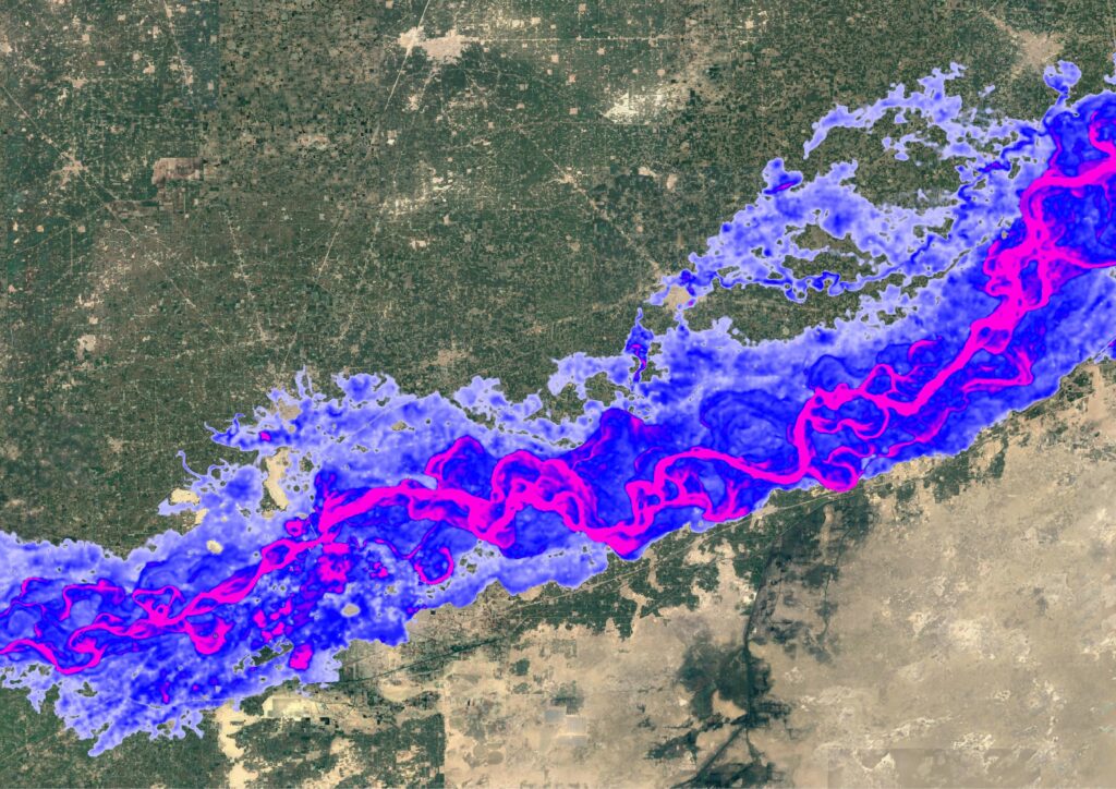
Coupling the latest topography and hydrography datasets with cutting-edge hydraulic modelling. Our latest terrain data, the first global digital elevation model with forest and buildings removed at a ~30-meter resolution and employing the most advanced representation of river channels available, including estimations of location, size and depth.
State of the art in flood data science:
- Fluvial, pluvial and coastal. The first complete global view of flood hazard
- Climate dynamics. Maps across time periods, warming levels and emissions scenarios
- API. On demand access to all of our spatial data
- 100% of river channels modelled.