-
Yamazaki, D.,
-
Ikeshima, D.,
-
Tawatari, R.,
-
Yamaguchi, T.,
-
O’Loughlin, F.,
-

-
-
Kanae, S.,
-


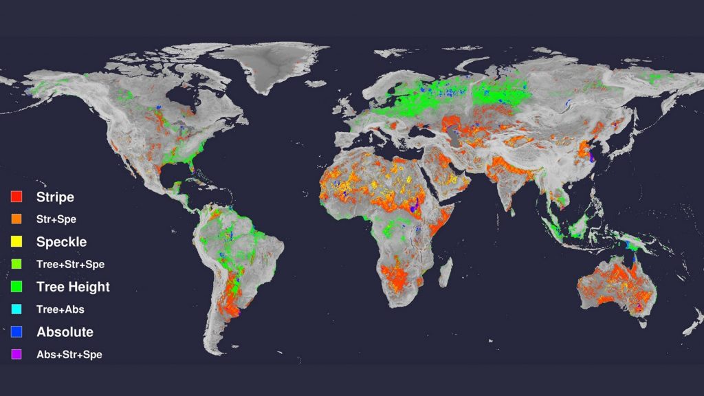
A significant set of systematic improvements to the SRTM terrain dataset produced by a project led by our colleague in Japan, Dai Yamazaki.
Spaceborne digital elevation models (DEMs) are a fundamental input for many geoscience studies, but they still include nonnegligible height errors.
Here we introduce a high-accuracy global DEM at 3″ resolution (~90 m at the equator) by eliminating major error components from existing DEMs. We separated absolute bias, stripe noise, speckle noise, and tree height bias using multiple satellite data sets and filtering techniques. After the error removal, land areas mapped with ±2 m or better vertical accuracy were increased from 39% to 58%. Significant improvements were found in flat regions where height errors larger than topography variability, and landscapes such as river networks and hill-valley structures, became clearly represented. We found the topography slope of previous DEMs was largely distorted in most of world major floodplains (e.g., Ganges, Nile, Niger, and Mekong) and swamp forests (e.g., Amazon, Congo, and Vasyugan). The newly developed DEM will enhance many geoscience applications which are terrain dependent.